You are here: Home > Network List > TS - TERRAscope (Southern California Seismic Network) Stations List
> Station MLAC Mammoth Lakes, California, USA > Earthquake Result Viewer
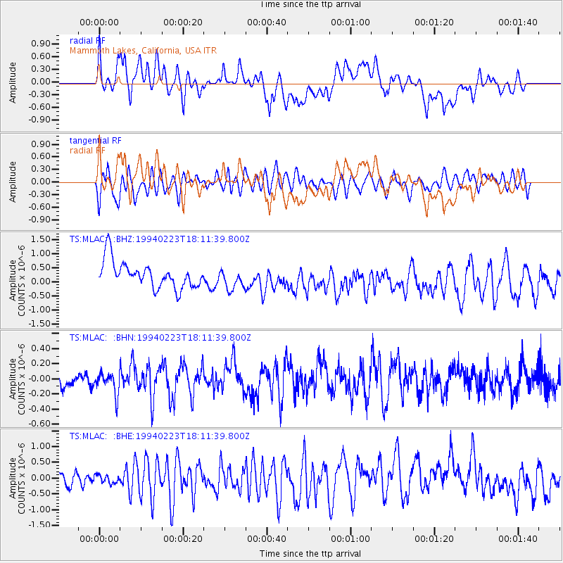
MLAC Mammoth Lakes, California, USA - Earthquake Result Viewer
*The percent match for this event was below the threshold and hence no stack was calculated.
| Earthquake location: |
Tonga Islands |
| Earthquake latitude/longitude: |
-17.4/-174.4 |
| Earthquake time(UTC): |
1994/02/23 (054) 18:00:29 GMT |
| Earthquake Depth: |
33 km |
| Earthquake Magnitude: |
5.6 MB, 5.0 MS |
| Earthquake Catalog/Contributor: |
WHDF/NEIC |
|
| Network: |
TS TERRAscope (Southern California Seismic Network) |
| Station: |
MLAC Mammoth Lakes, California, USA |
| Lat/Lon: |
37.63 N/118.83 W |
| Elevation: |
2170 m |
|
| Distance: |
75.6 deg |
| Az: |
42.52 deg |
| Baz: |
234.386 deg |
| Ray Param: |
$rayparam |
*The percent match for this event was below the threshold and hence was not used in the summary stack. |
|
| Radial Match: |
46.160404 % |
| Radial Bump: |
400 |
| Transverse Match: |
59.454903 % |
| Transverse Bump: |
400 |
| SOD ConfigId: |
4480 |
| Insert Time: |
2010-02-26 14:29:19.807 +0000 |
| GWidth: |
2.5 |
| Max Bumps: |
400 |
| Tol: |
0.001 |
|
Signal To Noise
| Channel | StoN | STA | LTA |
| TS:MLAC: :BHN:19940223T18:11:39.800Z | 1.664549 | 1.477574E-7 | 8.876722E-8 |
| TS:MLAC: :BHE:19940223T18:11:39.800Z | 0.5684916 | 2.722361E-7 | 4.788744E-7 |
| TS:MLAC: :BHZ:19940223T18:11:39.800Z | 0.81669277 | 3.8630583E-7 | 4.7301242E-7 |
| Arrivals |
| Ps | |
| PpPs | |
| PsPs/PpSs | |


