J10A Berg Farm, Melba ID, USA - Earthquake Result Viewer
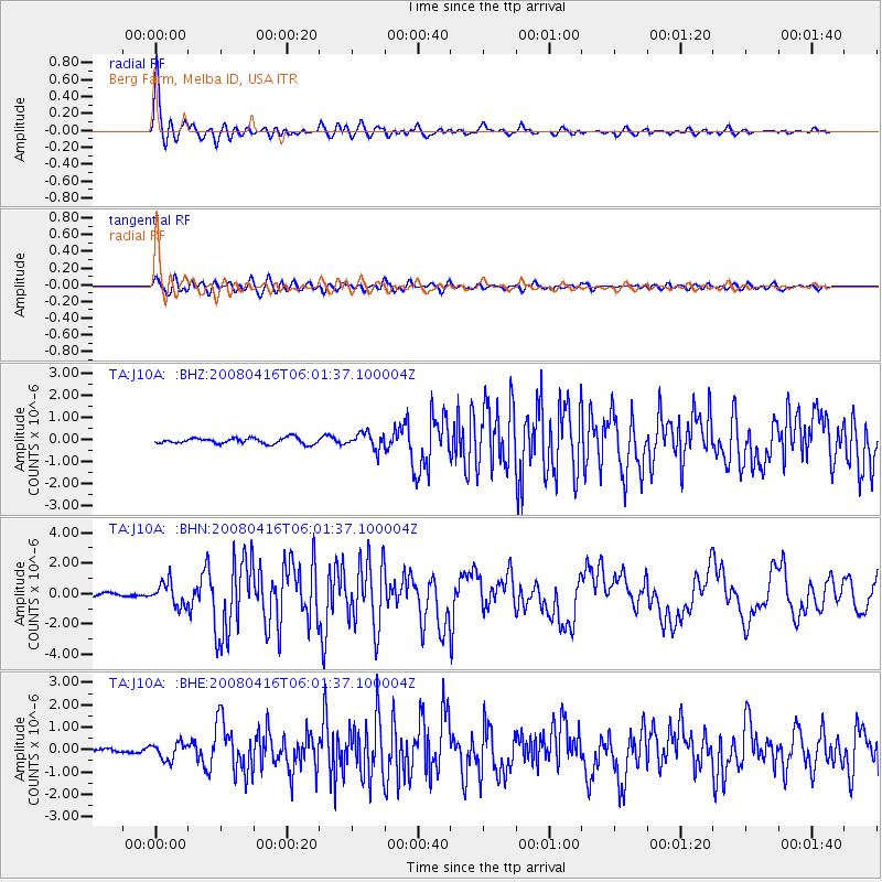
Earthquake location: Andreanof Islands, Aleutian Is.
Earthquake latitude/longitude: 51.9/-179.2
Earthquake time(UTC): 2008/04/16 (107) 05:54:19 GMT
Earthquake Depth: 13 km
Earthquake Magnitude: 6.1 MB, 6.5 MS, 6.6 MW, 6.6 MW
Earthquake Catalog/Contributor: WHDF/NEIC
Network: TA USArray Transportable Network (new EarthScope stations)
Station: J10A Berg Farm, Melba ID, USA
Lat/Lon: 43.43 N/116.77 W
Elevation: 748 m
Distance: 41.7 deg
Az: 76.101 deg
Baz: 304.313 deg
Ray Param: 0.07362484
Estimated Moho Depth: 61.5 km
Estimated Crust Vp/Vs: 2.02
Assumed Crust Vp: 6.291 km/s
Estimated Crust Vs: 3.122 km/s
Estimated Crust Poisson's Ratio: 0.34
Radial Match: 94.33897 %
Radial Bump: 388
Transverse Match: 78.570915 %
Transverse Bump: 400
SOD ConfigId: 2504
Insert Time: 2010-03-07 04:27:39.016 +0000
GWidth: 2.5
Max Bumps: 400
Tol: 0.001

Signal To Noise

ChannelStoNSTALTA
TA:J10A: :BHN:20080416T06:01:37.100004Z7.06592377.665224E-71.0848156E-7
TA:J10A: :BHE:20080416T06:01:37.100004Z3.85389163.7221523E-79.658165E-8
TA:J10A: :BHZ:20080416T06:01:37.100004Z2.71481943.618411E-71.3328368E-7
Arrivals
Ps11 SECOND
PpPs28 SECOND
PsPs/PpSs38 SECOND