You are here: Home > Network List > TA - USArray Transportable Network (new EarthScope stations) Stations List
> Station B18K Kokolik River, AK, USA > Earthquake Result Viewer
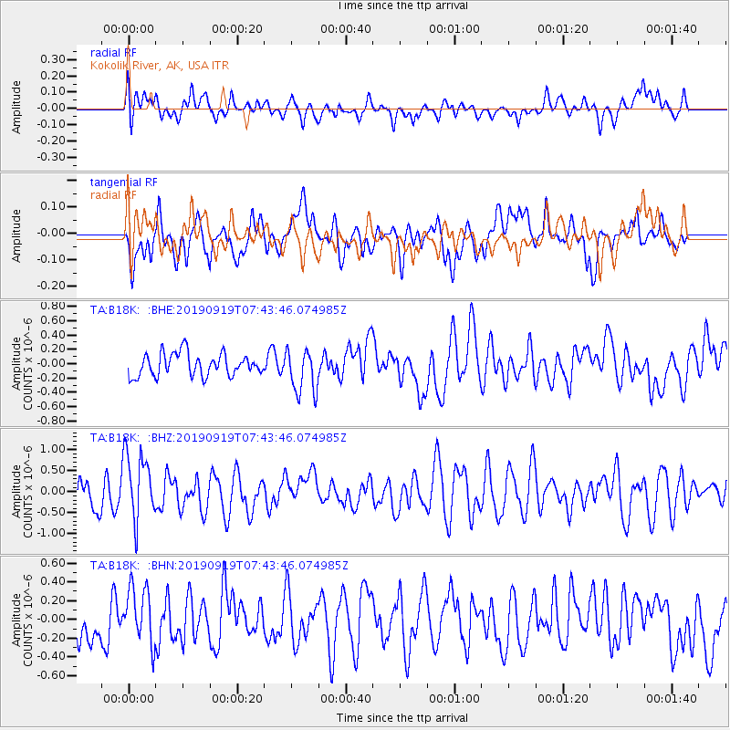
B18K Kokolik River, AK, USA - Earthquake Result Viewer
*The percent match for this event was below the threshold and hence no stack was calculated.
| Earthquake location: |
Java, Indonesia |
| Earthquake latitude/longitude: |
-6.1/111.9 |
| Earthquake time(UTC): |
2019/09/19 (262) 07:32:00 GMT |
| Earthquake Depth: |
591 km |
| Earthquake Magnitude: |
6.0 Mww |
| Earthquake Catalog/Contributor: |
NEIC PDE/us |
|
| Network: |
TA USArray Transportable Network (new EarthScope stations) |
| Station: |
B18K Kokolik River, AK, USA |
| Lat/Lon: |
69.36 N/161.80 W |
| Elevation: |
222 m |
|
| Distance: |
94.4 deg |
| Az: |
20.781 deg |
| Baz: |
264.408 deg |
| Ray Param: |
$rayparam |
*The percent match for this event was below the threshold and hence was not used in the summary stack. |
|
| Radial Match: |
38.086853 % |
| Radial Bump: |
400 |
| Transverse Match: |
48.262436 % |
| Transverse Bump: |
400 |
| SOD ConfigId: |
19053131 |
| Insert Time: |
2019-10-03 07:37:14.108 +0000 |
| GWidth: |
2.5 |
| Max Bumps: |
400 |
| Tol: |
0.001 |
|
Signal To Noise
| Channel | StoN | STA | LTA |
| TA:B18K: :BHZ:20190919T07:43:46.074985Z | 2.25948 | 8.017958E-7 | 3.5485854E-7 |
| TA:B18K: :BHN:20190919T07:43:46.074985Z | 1.4374818 | 3.007787E-7 | 2.0924001E-7 |
| TA:B18K: :BHE:20190919T07:43:46.074985Z | 1.9930612 | 3.1337404E-7 | 1.5723252E-7 |
| Arrivals |
| Ps | |
| PpPs | |
| PsPs/PpSs | |


