You are here: Home > Network List > US - United States National Seismic Network Stations List
> Station EGMT Eagleton, Montana, USA > Earthquake Result Viewer
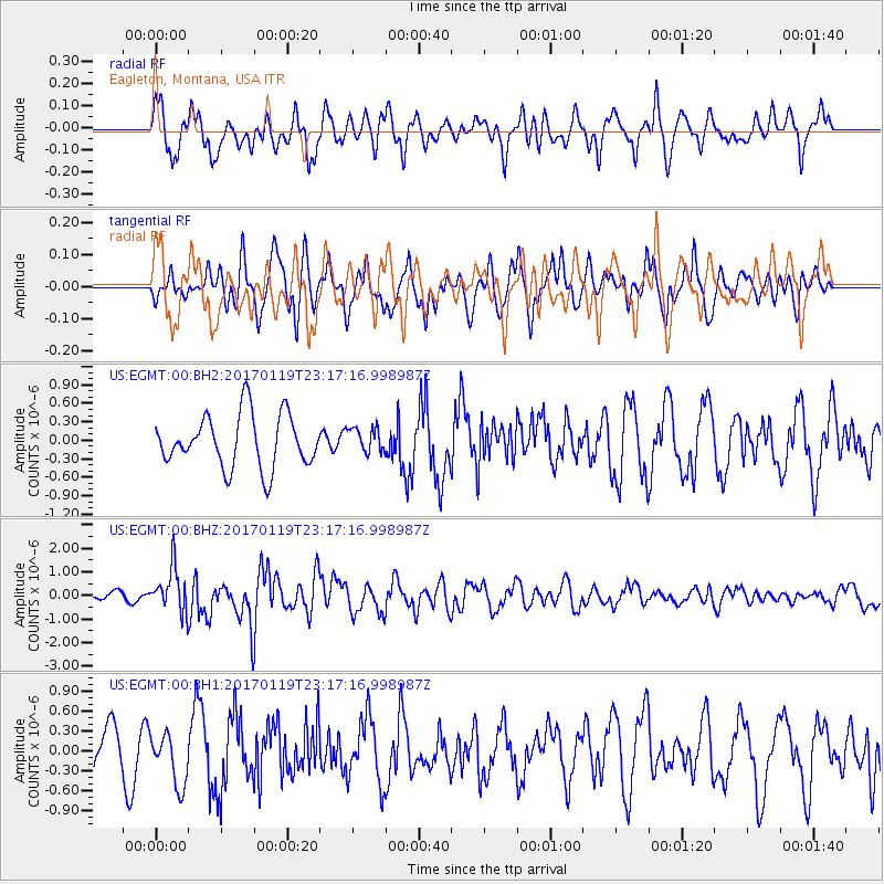
EGMT Eagleton, Montana, USA - Earthquake Result Viewer
*The percent match for this event was below the threshold and hence no stack was calculated.
| Earthquake location: |
Solomon Islands |
| Earthquake latitude/longitude: |
-10.4/161.3 |
| Earthquake time(UTC): |
2017/01/19 (019) 23:04:20 GMT |
| Earthquake Depth: |
34 km |
| Earthquake Magnitude: |
6.8 mwp |
| Earthquake Catalog/Contributor: |
NEIC PDE/us |
|
| Network: |
US United States National Seismic Network |
| Station: |
EGMT Eagleton, Montana, USA |
| Lat/Lon: |
48.02 N/109.75 W |
| Elevation: |
1055 m |
|
| Distance: |
96.9 deg |
| Az: |
42.54 deg |
| Baz: |
262.301 deg |
| Ray Param: |
$rayparam |
*The percent match for this event was below the threshold and hence was not used in the summary stack. |
|
| Radial Match: |
71.495316 % |
| Radial Bump: |
394 |
| Transverse Match: |
48.001385 % |
| Transverse Bump: |
400 |
| SOD ConfigId: |
1943534 |
| Insert Time: |
2017-02-02 23:06:36.355 +0000 |
| GWidth: |
2.5 |
| Max Bumps: |
400 |
| Tol: |
0.001 |
|
Signal To Noise
| Channel | StoN | STA | LTA |
| US:EGMT:00:BHZ:20170119T23:17:16.998987Z | 3.7141657 | 9.2940564E-7 | 2.502327E-7 |
| US:EGMT:00:BH1:20170119T23:17:16.998987Z | 1.323376 | 3.9986304E-7 | 3.0215375E-7 |
| US:EGMT:00:BH2:20170119T23:17:16.998987Z | 0.4643488 | 1.9742271E-7 | 4.2516038E-7 |
| Arrivals |
| Ps | |
| PpPs | |
| PsPs/PpSs | |


