You are here: Home > Network List > US - United States National Seismic Network Stations List
> Station MSO Missoula, Montana, USA > Earthquake Result Viewer
MSO Missoula, Montana, USA - Earthquake Result Viewer
*The percent match for this event was below the threshold and hence no stack was calculated.
| Earthquake location: |
Solomon Islands |
| Earthquake latitude/longitude: |
-10.4/161.3 |
| Earthquake time(UTC): |
2017/01/19 (019) 23:04:20 GMT |
| Earthquake Depth: |
34 km |
| Earthquake Magnitude: |
6.8 mwp |
| Earthquake Catalog/Contributor: |
NEIC PDE/us |
|
| Network: |
US United States National Seismic Network |
| Station: |
MSO Missoula, Montana, USA |
| Lat/Lon: |
46.83 N/113.94 W |
| Elevation: |
1264 m |
|
| Distance: |
93.9 deg |
| Az: |
43.265 deg |
| Baz: |
259.159 deg |
| Ray Param: |
$rayparam |
*The percent match for this event was below the threshold and hence was not used in the summary stack. |
|
| Radial Match: |
60.38765 % |
| Radial Bump: |
400 |
| Transverse Match: |
50.11752 % |
| Transverse Bump: |
400 |
| SOD ConfigId: |
1943534 |
| Insert Time: |
2017-02-02 23:06:48.130 +0000 |
| GWidth: |
2.5 |
| Max Bumps: |
400 |
| Tol: |
0.001 |
|
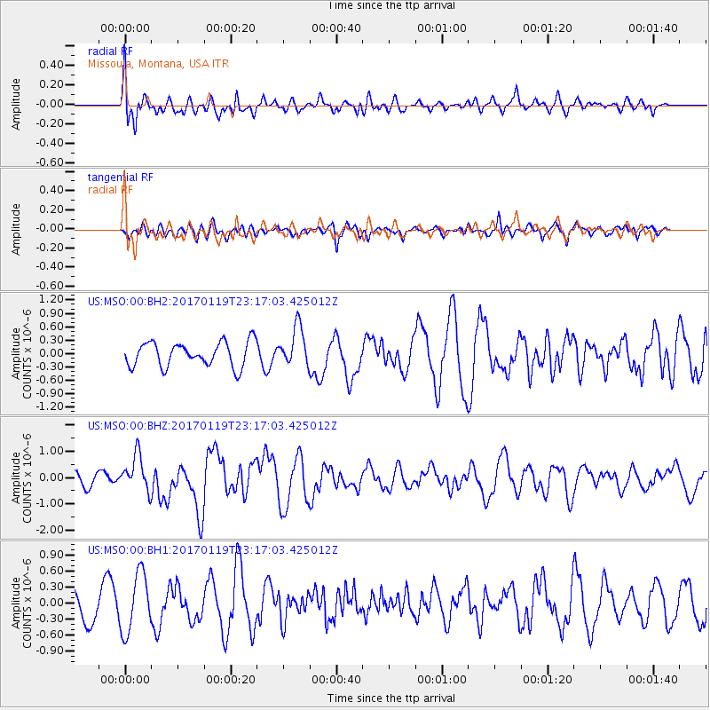
Signal To Noise
| Channel | StoN | STA | LTA |
| US:MSO:00:BHZ:20170119T23:17:03.425012Z | 2.683311 | 6.934349E-7 | 2.584251E-7 |
| US:MSO:00:BH1:20170119T23:17:03.425012Z | 1.6601444 | 5.596056E-7 | 3.3708247E-7 |
| US:MSO:00:BH2:20170119T23:17:03.425012Z | 1.6258241 | 4.431572E-7 | 2.7257389E-7 |
| Arrivals |
| Ps | |
| PpPs | |
| PsPs/PpSs | |


