You are here: Home > Network List > TS - TERRAscope (Southern California Seismic Network) Stations List
> Station MLAC Mammoth Lakes, California, USA > Earthquake Result Viewer
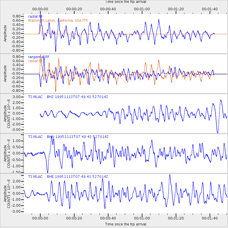
MLAC Mammoth Lakes, California, USA - Earthquake Result Viewer
*The percent match for this event was below the threshold and hence no stack was calculated.
| Earthquake location: |
Tonga Islands |
| Earthquake latitude/longitude: |
-15.1/-173.5 |
| Earthquake time(UTC): |
1995/11/13 (317) 07:38:45 GMT |
| Earthquake Depth: |
33 km |
| Earthquake Magnitude: |
5.7 MB, 5.9 MS, 6.1 UNKNOWN, 6.0 MW |
| Earthquake Catalog/Contributor: |
WHDF/NEIC |
|
| Network: |
TS TERRAscope (Southern California Seismic Network) |
| Station: |
MLAC Mammoth Lakes, California, USA |
| Lat/Lon: |
37.63 N/118.83 W |
| Elevation: |
2170 m |
|
| Distance: |
73.4 deg |
| Az: |
42.529 deg |
| Baz: |
235.324 deg |
| Ray Param: |
$rayparam |
*The percent match for this event was below the threshold and hence was not used in the summary stack. |
|
| Radial Match: |
66.290016 % |
| Radial Bump: |
400 |
| Transverse Match: |
62.394257 % |
| Transverse Bump: |
400 |
| SOD ConfigId: |
4480 |
| Insert Time: |
2010-02-26 14:29:26.101 +0000 |
| GWidth: |
2.5 |
| Max Bumps: |
400 |
| Tol: |
0.001 |
|
Signal To Noise
| Channel | StoN | STA | LTA |
| TS:MLAC: :BHN:19951113T07:49:43.527014Z | 3.7628403 | 5.847057E-7 | 1.5538944E-7 |
| TS:MLAC: :BHE:19951113T07:49:43.527014Z | 0.5625489 | 2.451385E-7 | 4.3576387E-7 |
| TS:MLAC: :BHZ:19951113T07:49:43.527014Z | 0.59378296 | 2.1969247E-7 | 3.6998784E-7 |
| Arrivals |
| Ps | |
| PpPs | |
| PsPs/PpSs | |


