You are here: Home > Network List > UU - University of Utah Regional Network Stations List
> Station CCUT Cedar City, UT, USA > Earthquake Result Viewer
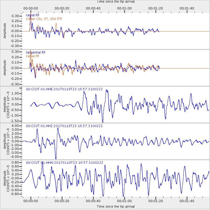
CCUT Cedar City, UT, USA - Earthquake Result Viewer
*The percent match for this event was below the threshold and hence no stack was calculated.
| Earthquake location: |
Solomon Islands |
| Earthquake latitude/longitude: |
-10.4/161.3 |
| Earthquake time(UTC): |
2017/01/19 (019) 23:04:20 GMT |
| Earthquake Depth: |
34 km |
| Earthquake Magnitude: |
6.8 mwp |
| Earthquake Catalog/Contributor: |
NEIC PDE/us |
|
| Network: |
UU University of Utah Regional Network |
| Station: |
CCUT Cedar City, UT, USA |
| Lat/Lon: |
37.55 N/113.36 W |
| Elevation: |
2127 m |
|
| Distance: |
92.6 deg |
| Az: |
52.465 deg |
| Baz: |
259.024 deg |
| Ray Param: |
$rayparam |
*The percent match for this event was below the threshold and hence was not used in the summary stack. |
|
| Radial Match: |
63.513714 % |
| Radial Bump: |
400 |
| Transverse Match: |
58.008923 % |
| Transverse Bump: |
400 |
| SOD ConfigId: |
1943534 |
| Insert Time: |
2017-02-02 23:07:05.703 +0000 |
| GWidth: |
2.5 |
| Max Bumps: |
400 |
| Tol: |
0.001 |
|
Signal To Noise
| Channel | StoN | STA | LTA |
| UU:CCUT:01:HHZ:20170119T23:16:57.310022Z | 3.842046 | 1.2191205E-6 | 3.1731022E-7 |
| UU:CCUT:01:HHN:20170119T23:16:57.310022Z | 1.4934192 | 3.2590575E-7 | 2.1822791E-7 |
| UU:CCUT:01:HHE:20170119T23:16:57.310022Z | 4.307982 | 5.3402306E-7 | 1.239613E-7 |
| Arrivals |
| Ps | |
| PpPs | |
| PsPs/PpSs | |


