You are here: Home > Network List > TA - USArray Transportable Network (new EarthScope stations) Stations List
> Station H16K Elim, AK, USA > Earthquake Result Viewer
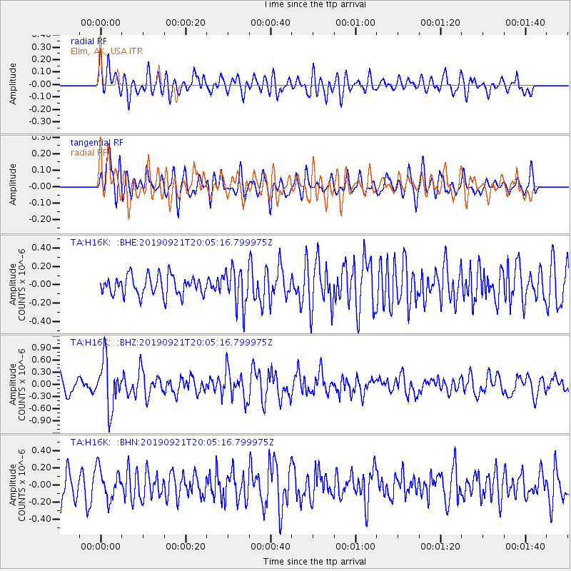
H16K Elim, AK, USA - Earthquake Result Viewer
*The percent match for this event was below the threshold and hence no stack was calculated.
| Earthquake location: |
Banda Sea |
| Earthquake latitude/longitude: |
-6.5/130.4 |
| Earthquake time(UTC): |
2019/09/21 (264) 19:53:10 GMT |
| Earthquake Depth: |
48 km |
| Earthquake Magnitude: |
5.9 Mww |
| Earthquake Catalog/Contributor: |
NEIC PDE/us |
|
| Network: |
TA USArray Transportable Network (new EarthScope stations) |
| Station: |
H16K Elim, AK, USA |
| Lat/Lon: |
64.64 N/162.24 W |
| Elevation: |
216 m |
|
| Distance: |
86.4 deg |
| Az: |
23.464 deg |
| Baz: |
246.725 deg |
| Ray Param: |
$rayparam |
*The percent match for this event was below the threshold and hence was not used in the summary stack. |
|
| Radial Match: |
66.561584 % |
| Radial Bump: |
400 |
| Transverse Match: |
55.29322 % |
| Transverse Bump: |
400 |
| SOD ConfigId: |
19053131 |
| Insert Time: |
2019-10-05 20:00:20.242 +0000 |
| GWidth: |
2.5 |
| Max Bumps: |
400 |
| Tol: |
0.001 |
|
Signal To Noise
| Channel | StoN | STA | LTA |
| TA:H16K: :BHZ:20190921T20:05:16.799975Z | 3.6393034 | 5.9991464E-7 | 1.6484327E-7 |
| TA:H16K: :BHN:20190921T20:05:16.799975Z | 1.1831653 | 1.7983004E-7 | 1.5199063E-7 |
| TA:H16K: :BHE:20190921T20:05:16.799975Z | 1.9752189 | 2.0602769E-7 | 1.0430625E-7 |
| Arrivals |
| Ps | |
| PpPs | |
| PsPs/PpSs | |


