You are here: Home > Network List > WY - Yellowstone Wyoming Seismic Network Stations List
> Station YHR Hawk's Rest, WY, USA > Earthquake Result Viewer
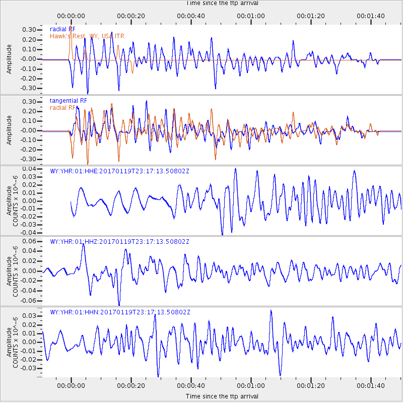
YHR Hawk's Rest, WY, USA - Earthquake Result Viewer
*The percent match for this event was below the threshold and hence no stack was calculated.
| Earthquake location: |
Solomon Islands |
| Earthquake latitude/longitude: |
-10.4/161.3 |
| Earthquake time(UTC): |
2017/01/19 (019) 23:04:20 GMT |
| Earthquake Depth: |
34 km |
| Earthquake Magnitude: |
6.8 mwp |
| Earthquake Catalog/Contributor: |
NEIC PDE/us |
|
| Network: |
WY Yellowstone Wyoming Seismic Network |
| Station: |
YHR Hawk's Rest, WY, USA |
| Lat/Lon: |
44.11 N/110.08 W |
| Elevation: |
2976 m |
|
| Distance: |
96.1 deg |
| Az: |
46.414 deg |
| Baz: |
261.626 deg |
| Ray Param: |
$rayparam |
*The percent match for this event was below the threshold and hence was not used in the summary stack. |
|
| Radial Match: |
68.68159 % |
| Radial Bump: |
400 |
| Transverse Match: |
65.126434 % |
| Transverse Bump: |
400 |
| SOD ConfigId: |
1943534 |
| Insert Time: |
2017-02-02 23:07:58.628 +0000 |
| GWidth: |
2.5 |
| Max Bumps: |
400 |
| Tol: |
0.001 |
|
Signal To Noise
| Channel | StoN | STA | LTA |
| WY:YHR:01:HHZ:20170119T23:17:13.50802Z | 5.1147156 | 2.3725024E-8 | 4.638581E-9 |
| WY:YHR:01:HHN:20170119T23:17:13.50802Z | 0.6524999 | 5.6821197E-9 | 8.708231E-9 |
| WY:YHR:01:HHE:20170119T23:17:13.50802Z | 0.8821003 | 8.353837E-9 | 9.470393E-9 |
| Arrivals |
| Ps | |
| PpPs | |
| PsPs/PpSs | |


