You are here: Home > Network List > TS - TERRAscope (Southern California Seismic Network) Stations List
> Station MLAC Mammoth Lakes, California, USA > Earthquake Result Viewer
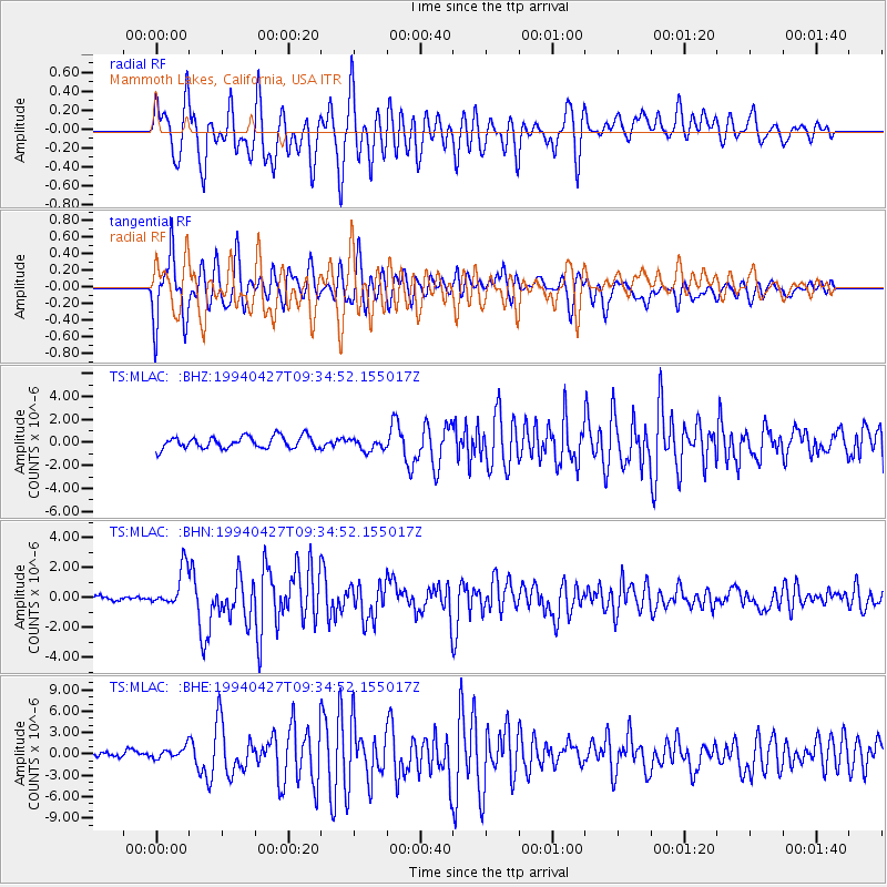
MLAC Mammoth Lakes, California, USA - Earthquake Result Viewer
*The percent match for this event was below the threshold and hence no stack was calculated.
| Earthquake location: |
Tonga Islands |
| Earthquake latitude/longitude: |
-21.5/-173.7 |
| Earthquake time(UTC): |
1994/04/27 (117) 09:23:27 GMT |
| Earthquake Depth: |
35 km |
| Earthquake Magnitude: |
6.2 MB, 6.1 MS, 6.0 UNKNOWN, 6.4 MW |
| Earthquake Catalog/Contributor: |
WHDF/NEIC |
|
| Network: |
TS TERRAscope (Southern California Seismic Network) |
| Station: |
MLAC Mammoth Lakes, California, USA |
| Lat/Lon: |
37.63 N/118.83 W |
| Elevation: |
2170 m |
|
| Distance: |
78.2 deg |
| Az: |
41.554 deg |
| Baz: |
231.093 deg |
| Ray Param: |
$rayparam |
*The percent match for this event was below the threshold and hence was not used in the summary stack. |
|
| Radial Match: |
76.979836 % |
| Radial Bump: |
400 |
| Transverse Match: |
56.867165 % |
| Transverse Bump: |
400 |
| SOD ConfigId: |
4480 |
| Insert Time: |
2010-02-26 14:29:33.514 +0000 |
| GWidth: |
2.5 |
| Max Bumps: |
400 |
| Tol: |
0.001 |
|
Signal To Noise
| Channel | StoN | STA | LTA |
| TS:MLAC: :BHN:19940427T09:34:52.155017Z | 4.31884 | 1.3109202E-6 | 3.0353527E-7 |
| TS:MLAC: :BHE:19940427T09:34:52.155017Z | 1.3515015 | 8.367077E-7 | 6.19095E-7 |
| TS:MLAC: :BHZ:19940427T09:34:52.155017Z | 1.0536213 | 5.522782E-7 | 5.241714E-7 |
| Arrivals |
| Ps | |
| PpPs | |
| PsPs/PpSs | |


