You are here: Home > Network List > IU - Global Seismograph Network (GSN - IRIS/USGS) Stations List
> Station XMAS Kiritimati Island, Republic of Kiribati > Earthquake Result Viewer
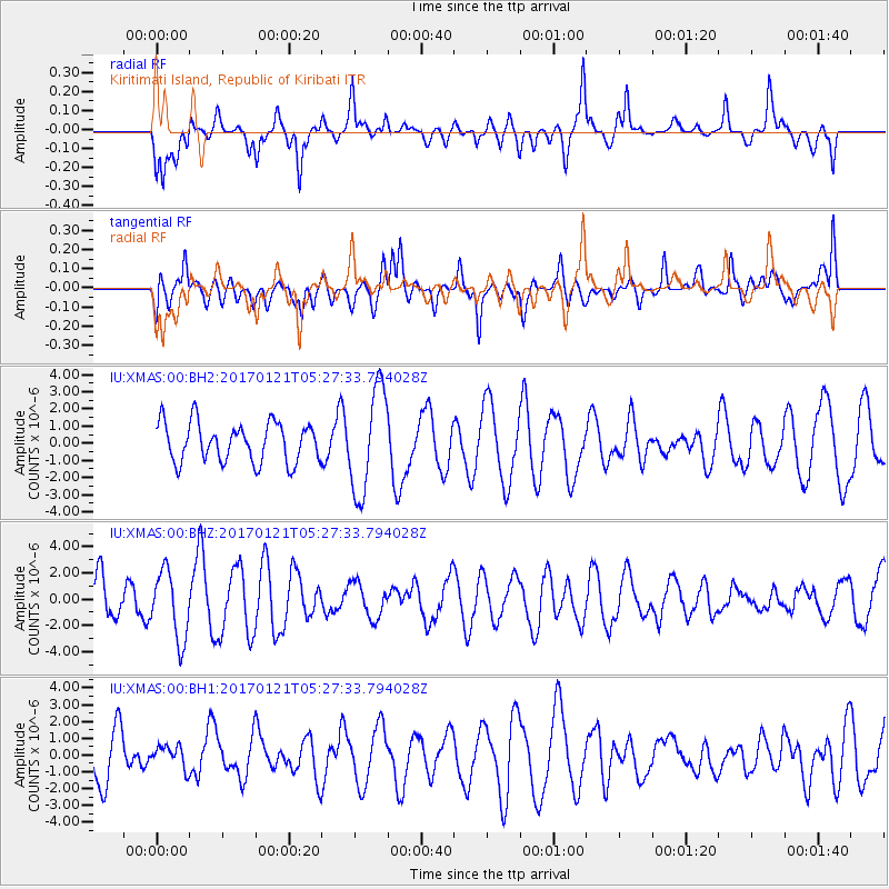
XMAS Kiritimati Island, Republic of Kiribati - Earthquake Result Viewer
*The percent match for this event was below the threshold and hence no stack was calculated.
| Earthquake location: |
Halmahera, Indonesia |
| Earthquake latitude/longitude: |
2.8/128.2 |
| Earthquake time(UTC): |
2017/01/21 (021) 05:16:33 GMT |
| Earthquake Depth: |
58 km |
| Earthquake Magnitude: |
5.7 mb |
| Earthquake Catalog/Contributor: |
NEIC PDE/us |
|
| Network: |
IU Global Seismograph Network (GSN - IRIS/USGS) |
| Station: |
XMAS Kiritimati Island, Republic of Kiribati |
| Lat/Lon: |
2.04 N/157.45 W |
| Elevation: |
20 m |
|
| Distance: |
74.3 deg |
| Az: |
88.672 deg |
| Baz: |
272.323 deg |
| Ray Param: |
$rayparam |
*The percent match for this event was below the threshold and hence was not used in the summary stack. |
|
| Radial Match: |
56.524998 % |
| Radial Bump: |
400 |
| Transverse Match: |
47.587307 % |
| Transverse Bump: |
400 |
| SOD ConfigId: |
1943534 |
| Insert Time: |
2017-02-04 05:20:58.937 +0000 |
| GWidth: |
2.5 |
| Max Bumps: |
400 |
| Tol: |
0.001 |
|
Signal To Noise
| Channel | StoN | STA | LTA |
| IU:XMAS:00:BHZ:20170121T05:27:33.794028Z | 1.9670815 | 2.5771387E-6 | 1.3101331E-6 |
| IU:XMAS:00:BH1:20170121T05:27:33.794028Z | 0.40451756 | 6.774356E-7 | 1.6746753E-6 |
| IU:XMAS:00:BH2:20170121T05:27:33.794028Z | 2.673344 | 3.0546335E-6 | 1.1426265E-6 |
| Arrivals |
| Ps | |
| PpPs | |
| PsPs/PpSs | |


