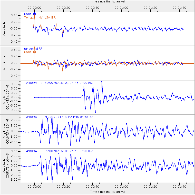
R09A Tonopah, NV, USA - Earthquake Result Viewer
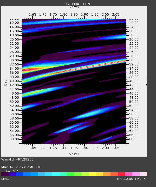
Earthquake location: Near West Coast Of Honshu, Japan
Earthquake latitude/longitude: 37.5/138.4
Earthquake time(UTC): 2007/07/16 (197) 01:13:22 GMT
Earthquake Depth: 12 km
Earthquake Magnitude: 6.5 MB, 6.4 MS, 6.6 MW, 6.5 MW
Earthquake Catalog/Contributor: WHDF/NEIC
Network: TA USArray Transportable Network (new EarthScope stations)
Station: R09A Tonopah, NV, USA
Lat/Lon: 38.24 N/117.07 W
Elevation: 1759 m
Distance: 77.4 deg
Az: 51.362 deg
Baz: 307.949 deg
Ray Param: 0.050315075
Estimated Moho Depth: 32.75 km
Estimated Crust Vp/Vs: 1.92
Assumed Crust Vp: 6.276 km/s
Estimated Crust Vs: 3.26 km/s
Estimated Crust Poisson's Ratio: 0.32
Radial Match: 97.29256 %
Radial Bump: 400
Transverse Match: 92.45612 %
Transverse Bump: 400
SOD ConfigId: 2564
Insert Time: 2010-03-07 04:33:28.819 +0000
GWidth: 2.5
Max Bumps: 400
Tol: 0.001

Signal To Noise

ChannelStoNSTALTA
TA:R09A: :BHN:20070716T01:24:46.049016Z14.8725616.0866495E-74.092536E-8
TA:R09A: :BHE:20070716T01:24:46.049016Z14.7711077.138034E-74.83243E-8
TA:R09A: :BHZ:20070716T01:24:46.049016Z34.661692.4362328E-67.028604E-8
Arrivals
Ps5.0 SECOND
PpPs15 SECOND
PsPs/PpSs20 SECOND