R09A Tonopah, NV, USA - Earthquake Result Viewer
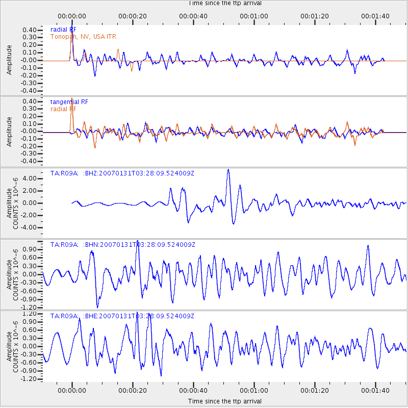
Earthquake location: Kermadec Islands, New Zealand
Earthquake latitude/longitude: -29.8/-178.0
Earthquake time(UTC): 2007/01/31 (031) 03:15:52 GMT
Earthquake Depth: 34 km
Earthquake Magnitude: 6.1 MB, 6.3 MS, 6.5 MW, 6.4 MW
Earthquake Catalog/Contributor: WHDF/NEIC
Network: TA USArray Transportable Network (new EarthScope stations)
Station: R09A Tonopah, NV, USA
Lat/Lon: 38.24 N/117.07 W
Elevation: 1759 m
Distance: 88.4 deg
Az: 43.513 deg
Baz: 229.48 deg
Ray Param: 0.042577162
Estimated Moho Depth: 61.25 km
Estimated Crust Vp/Vs: 1.62
Assumed Crust Vp: 6.276 km/s
Estimated Crust Vs: 3.874 km/s
Estimated Crust Poisson's Ratio: 0.19
Radial Match: 83.71866 %
Radial Bump: 400
Transverse Match: 67.80486 %
Transverse Bump: 400
SOD ConfigId: 2564
Insert Time: 2010-03-07 04:33:45.050 +0000
GWidth: 2.5
Max Bumps: 400
Tol: 0.001

Signal To Noise

ChannelStoNSTALTA
TA:R09A: :BHN:20070131T03:28:09.524009Z0.86073792.2151976E-72.5736028E-7
TA:R09A: :BHE:20070131T03:28:09.524009Z1.85796385.064578E-72.7258756E-7
TA:R09A: :BHZ:20070131T03:28:09.524009Z4.56666669.566198E-72.094788E-7
Arrivals
Ps6.2 SECOND
PpPs25 SECOND
PsPs/PpSs31 SECOND