You are here: Home > Network List > TS - TERRAscope (Southern California Seismic Network) Stations List
> Station MLAC Mammoth Lakes, California, USA > Earthquake Result Viewer
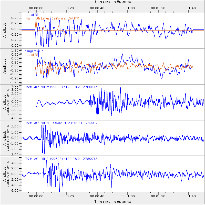
MLAC Mammoth Lakes, California, USA - Earthquake Result Viewer
*The percent match for this event was below the threshold and hence no stack was calculated.
| Earthquake location: |
Southeast Of Honshu, Japan |
| Earthquake latitude/longitude: |
29.2/140.4 |
| Earthquake time(UTC): |
1996/02/14 (045) 21:26:56 GMT |
| Earthquake Depth: |
142 km |
| Earthquake Magnitude: |
5.9 MB |
| Earthquake Catalog/Contributor: |
WHDF/NEIC |
|
| Network: |
TS TERRAscope (Southern California Seismic Network) |
| Station: |
MLAC Mammoth Lakes, California, USA |
| Lat/Lon: |
37.63 N/118.83 W |
| Elevation: |
2170 m |
|
| Distance: |
80.5 deg |
| Az: |
52.262 deg |
| Baz: |
299.459 deg |
| Ray Param: |
$rayparam |
*The percent match for this event was below the threshold and hence was not used in the summary stack. |
|
| Radial Match: |
64.17999 % |
| Radial Bump: |
400 |
| Transverse Match: |
61.71463 % |
| Transverse Bump: |
400 |
| SOD ConfigId: |
4480 |
| Insert Time: |
2010-02-26 14:29:53.383 +0000 |
| GWidth: |
2.5 |
| Max Bumps: |
400 |
| Tol: |
0.001 |
|
Signal To Noise
| Channel | StoN | STA | LTA |
| TS:MLAC: :BHN:19960214T21:38:21.278003Z | 8.105319 | 9.2511516E-7 | 1.14136796E-7 |
| TS:MLAC: :BHE:19960214T21:38:21.278003Z | 2.2032192 | 9.59089E-7 | 4.3531256E-7 |
| TS:MLAC: :BHZ:19960214T21:38:21.278003Z | 1.1285526 | 4.2298754E-7 | 3.7480535E-7 |
| Arrivals |
| Ps | |
| PpPs | |
| PsPs/PpSs | |


