You are here: Home > Network List > TA - USArray Transportable Network (new EarthScope stations) Stations List
> Station HAST UC Hastings Reserve, Carmel Valley, CA, USA > Earthquake Result Viewer
HAST UC Hastings Reserve, Carmel Valley, CA, USA - Earthquake Result Viewer

| Earthquake location: |
Rat Islands, Aleutian Islands |
| Earthquake latitude/longitude: |
51.8/177.1 |
| Earthquake time(UTC): |
2006/06/14 (165) 04:18:42 GMT |
| Earthquake Depth: |
14 km |
| Earthquake Magnitude: |
5.9 MB, 6.4 MS, 6.4 MW, 6.4 MW |
| Earthquake Catalog/Contributor: |
WHDF/NEIC |
|
| Network: |
TA USArray Transportable Network (new EarthScope stations) |
| Station: |
HAST UC Hastings Reserve, Carmel Valley, CA, USA |
| Lat/Lon: |
36.39 N/121.55 W |
| Elevation: |
542 m |
|
| Distance: |
45.3 deg |
| Az: |
84.813 deg |
| Baz: |
309.894 deg |
| Ray Param: |
0.07134051 |
| Estimated Moho Depth: |
58.25 km |
| Estimated Crust Vp/Vs: |
2.06 |
| Assumed Crust Vp: |
6.391 km/s |
| Estimated Crust Vs: |
3.11 km/s |
| Estimated Crust Poisson's Ratio: |
0.34 |
|
| Radial Match: |
91.70065 % |
| Radial Bump: |
400 |
| Transverse Match: |
82.23798 % |
| Transverse Bump: |
400 |
| SOD ConfigId: |
5745 |
| Insert Time: |
2010-03-07 04:38:44.107 +0000 |
| GWidth: |
2.5 |
| Max Bumps: |
400 |
| Tol: |
0.001 |
|
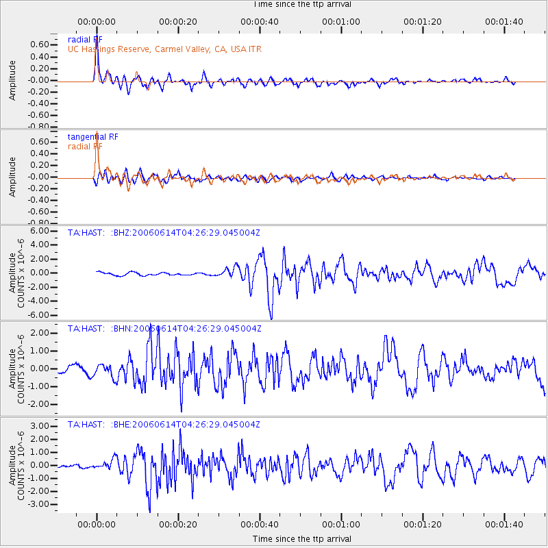
Signal To Noise
| Channel | StoN | STA | LTA |
| TA:HAST: :BHN:20060614T04:26:29.045004Z | 1.9220454 | 3.6313818E-7 | 1.8893321E-7 |
| TA:HAST: :BHE:20060614T04:26:29.045004Z | 2.3095663 | 4.0585482E-7 | 1.7572772E-7 |
| TA:HAST: :BHZ:20060614T04:26:29.045004Z | 3.5377507 | 7.192836E-7 | 2.0331665E-7 |
| Arrivals |
| Ps | 10 SECOND |
| PpPs | 26 SECOND |
| PsPs/PpSs | 37 SECOND |


