You are here: Home > Network List > TS - TERRAscope (Southern California Seismic Network) Stations List
> Station MLAC Mammoth Lakes, California, USA > Earthquake Result Viewer
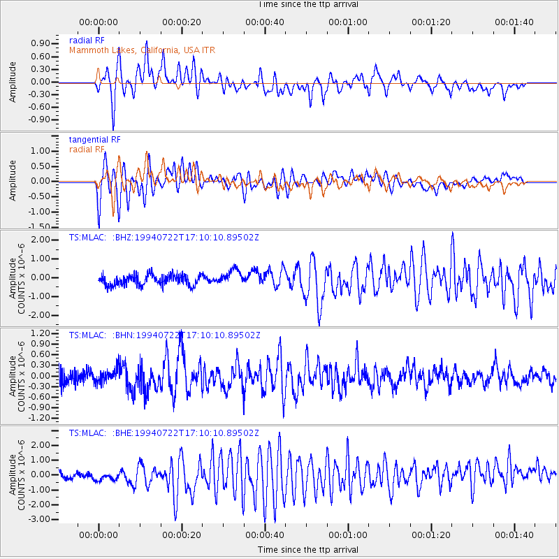
MLAC Mammoth Lakes, California, USA - Earthquake Result Viewer
*The percent match for this event was below the threshold and hence no stack was calculated.
| Earthquake location: |
Solomon Islands |
| Earthquake latitude/longitude: |
-7.7/158.3 |
| Earthquake time(UTC): |
1994/07/22 (203) 16:57:50 GMT |
| Earthquake Depth: |
31 km |
| Earthquake Magnitude: |
5.7 MB, 6.0 MS, 6.1 UNKNOWN |
| Earthquake Catalog/Contributor: |
WHDF/NEIC |
|
| Network: |
TS TERRAscope (Southern California Seismic Network) |
| Station: |
MLAC Mammoth Lakes, California, USA |
| Lat/Lon: |
37.63 N/118.83 W |
| Elevation: |
2170 m |
|
| Distance: |
89.0 deg |
| Az: |
51.983 deg |
| Baz: |
259.592 deg |
| Ray Param: |
$rayparam |
*The percent match for this event was below the threshold and hence was not used in the summary stack. |
|
| Radial Match: |
79.24952 % |
| Radial Bump: |
400 |
| Transverse Match: |
60.68132 % |
| Transverse Bump: |
400 |
| SOD ConfigId: |
4480 |
| Insert Time: |
2010-02-26 14:30:00.636 +0000 |
| GWidth: |
2.5 |
| Max Bumps: |
400 |
| Tol: |
0.001 |
|
Signal To Noise
| Channel | StoN | STA | LTA |
| TS:MLAC: :BHN:19940722T17:10:10.89502Z | 1.0246485 | 1.9963208E-7 | 1.9482982E-7 |
| TS:MLAC: :BHE:19940722T17:10:10.89502Z | 1.4644356 | 7.5763677E-7 | 5.1735753E-7 |
| TS:MLAC: :BHZ:19940722T17:10:10.89502Z | 1.5383642 | 4.3325656E-7 | 2.8163458E-7 |
| Arrivals |
| Ps | |
| PpPs | |
| PsPs/PpSs | |


