You are here: Home > Network List > TA - USArray Transportable Network (new EarthScope stations) Stations List
> Station B18K Kokolik River, AK, USA > Earthquake Result Viewer
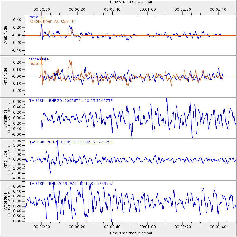
B18K Kokolik River, AK, USA - Earthquake Result Viewer
*The percent match for this event was below the threshold and hence no stack was calculated.
| Earthquake location: |
Turkey |
| Earthquake latitude/longitude: |
40.9/28.2 |
| Earthquake time(UTC): |
2019/09/26 (269) 10:59:26 GMT |
| Earthquake Depth: |
10 km |
| Earthquake Magnitude: |
5.7 Mww |
| Earthquake Catalog/Contributor: |
NEIC PDE/us |
|
| Network: |
TA USArray Transportable Network (new EarthScope stations) |
| Station: |
B18K Kokolik River, AK, USA |
| Lat/Lon: |
69.36 N/161.80 W |
| Elevation: |
222 m |
|
| Distance: |
69.8 deg |
| Az: |
3.751 deg |
| Baz: |
351.958 deg |
| Ray Param: |
$rayparam |
*The percent match for this event was below the threshold and hence was not used in the summary stack. |
|
| Radial Match: |
74.90924 % |
| Radial Bump: |
400 |
| Transverse Match: |
64.10892 % |
| Transverse Bump: |
400 |
| SOD ConfigId: |
19053131 |
| Insert Time: |
2019-10-10 11:08:19.411 +0000 |
| GWidth: |
2.5 |
| Max Bumps: |
400 |
| Tol: |
0.001 |
|
Signal To Noise
| Channel | StoN | STA | LTA |
| TA:B18K: :BHZ:20190926T11:10:05.524975Z | 3.8560312 | 9.251836E-7 | 2.3993155E-7 |
| TA:B18K: :BHN:20190926T11:10:05.524975Z | 1.5220369 | 2.3379347E-7 | 1.5360565E-7 |
| TA:B18K: :BHE:20190926T11:10:05.524975Z | 1.3748602 | 1.6365118E-7 | 1.1903114E-7 |
| Arrivals |
| Ps | |
| PpPs | |
| PsPs/PpSs | |


