You are here: Home > Network List > G - GEOSCOPE Stations List
> Station TAOE Taiohae, Marquises islands > Earthquake Result Viewer
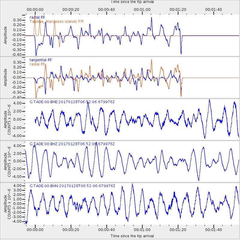
TAOE Taiohae, Marquises islands - Earthquake Result Viewer
*The percent match for this event was below the threshold and hence no stack was calculated.
| Earthquake location: |
Near Coast Of Northern Peru |
| Earthquake latitude/longitude: |
-9.3/-78.9 |
| Earthquake time(UTC): |
2017/01/28 (028) 06:42:32 GMT |
| Earthquake Depth: |
46 km |
| Earthquake Magnitude: |
5.3 Mww |
| Earthquake Catalog/Contributor: |
NEIC PDE/us |
|
| Network: |
G GEOSCOPE |
| Station: |
TAOE Taiohae, Marquises islands |
| Lat/Lon: |
8.85 S/140.15 W |
| Elevation: |
800 m |
|
| Distance: |
60.4 deg |
| Az: |
265.08 deg |
| Baz: |
95.691 deg |
| Ray Param: |
$rayparam |
*The percent match for this event was below the threshold and hence was not used in the summary stack. |
|
| Radial Match: |
58.788372 % |
| Radial Bump: |
400 |
| Transverse Match: |
49.964565 % |
| Transverse Bump: |
324 |
| SOD ConfigId: |
1943534 |
| Insert Time: |
2017-02-11 06:44:07.351 +0000 |
| GWidth: |
2.5 |
| Max Bumps: |
400 |
| Tol: |
0.001 |
|
Signal To Noise
| Channel | StoN | STA | LTA |
| G:TAOE:00:BHZ:20170128T06:52:06.679976Z | 1.8514762 | 3.1386596E-6 | 1.6952201E-6 |
| G:TAOE:00:BHN:20170128T06:52:06.679976Z | 0.8460945 | 1.4177543E-6 | 1.6756453E-6 |
| G:TAOE:00:BHE:20170128T06:52:06.679976Z | 1.6497198 | 2.1117073E-6 | 1.28004E-6 |
| Arrivals |
| Ps | |
| PpPs | |
| PsPs/PpSs | |


