You are here: Home > Network List > TA - USArray Transportable Network (new EarthScope stations) Stations List
> Station R33M Jennings River, BC, CAN > Earthquake Result Viewer
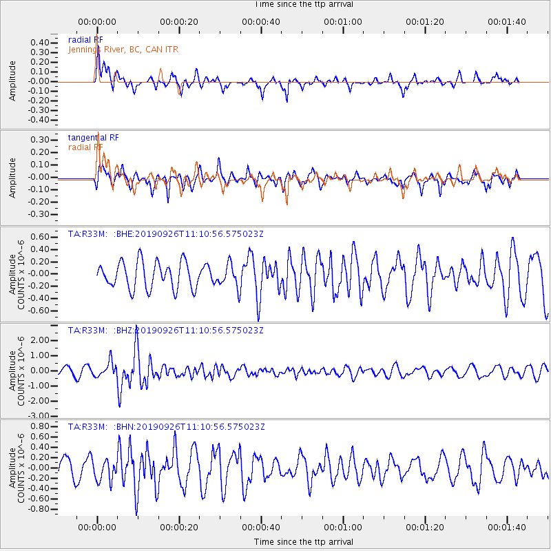
R33M Jennings River, BC, CAN - Earthquake Result Viewer
*The percent match for this event was below the threshold and hence no stack was calculated.
| Earthquake location: |
Turkey |
| Earthquake latitude/longitude: |
40.9/28.2 |
| Earthquake time(UTC): |
2019/09/26 (269) 10:59:26 GMT |
| Earthquake Depth: |
10 km |
| Earthquake Magnitude: |
5.7 Mww |
| Earthquake Catalog/Contributor: |
NEIC PDE/us |
|
| Network: |
TA USArray Transportable Network (new EarthScope stations) |
| Station: |
R33M Jennings River, BC, CAN |
| Lat/Lon: |
59.39 N/130.97 W |
| Elevation: |
1437 m |
|
| Distance: |
78.6 deg |
| Az: |
349.288 deg |
| Baz: |
15.986 deg |
| Ray Param: |
$rayparam |
*The percent match for this event was below the threshold and hence was not used in the summary stack. |
|
| Radial Match: |
59.590492 % |
| Radial Bump: |
400 |
| Transverse Match: |
62.27206 % |
| Transverse Bump: |
400 |
| SOD ConfigId: |
19053131 |
| Insert Time: |
2019-10-10 11:09:41.506 +0000 |
| GWidth: |
2.5 |
| Max Bumps: |
400 |
| Tol: |
0.001 |
|
Signal To Noise
| Channel | StoN | STA | LTA |
| TA:R33M: :BHZ:20190926T11:10:56.575023Z | 1.6690099 | 5.024449E-7 | 3.0104366E-7 |
| TA:R33M: :BHN:20190926T11:10:56.575023Z | 0.76011133 | 2.0140668E-7 | 2.6496997E-7 |
| TA:R33M: :BHE:20190926T11:10:56.575023Z | 0.87863606 | 1.9096665E-7 | 2.1734442E-7 |
| Arrivals |
| Ps | |
| PpPs | |
| PsPs/PpSs | |


