You are here: Home > Network List > US - United States National Seismic Network Stations List
> Station CBKS Cedar Bluff, Kansas, USA > Earthquake Result Viewer
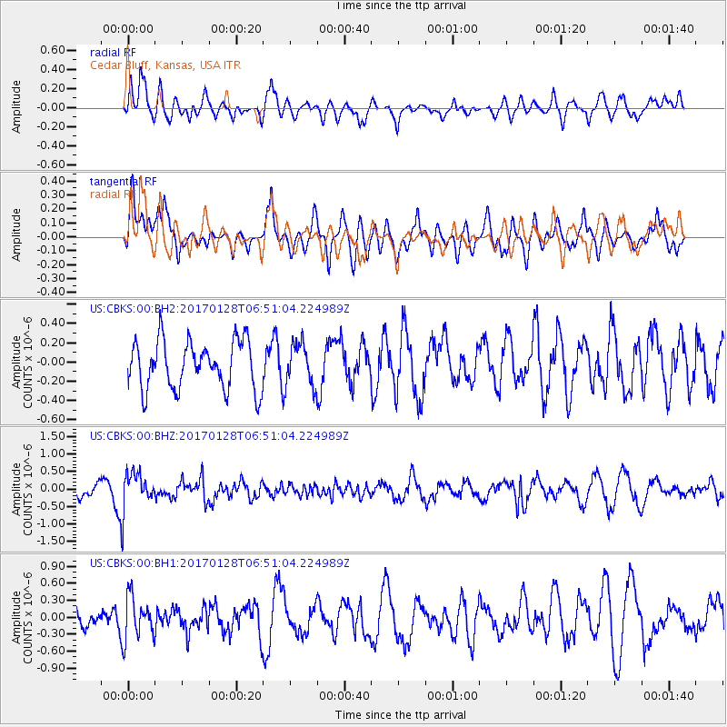
CBKS Cedar Bluff, Kansas, USA - Earthquake Result Viewer
*The percent match for this event was below the threshold and hence no stack was calculated.
| Earthquake location: |
Near Coast Of Northern Peru |
| Earthquake latitude/longitude: |
-9.3/-78.9 |
| Earthquake time(UTC): |
2017/01/28 (028) 06:42:32 GMT |
| Earthquake Depth: |
46 km |
| Earthquake Magnitude: |
5.3 Mww |
| Earthquake Catalog/Contributor: |
NEIC PDE/us |
|
| Network: |
US United States National Seismic Network |
| Station: |
CBKS Cedar Bluff, Kansas, USA |
| Lat/Lon: |
38.81 N/99.74 W |
| Elevation: |
677 m |
|
| Distance: |
51.7 deg |
| Az: |
339.235 deg |
| Baz: |
153.39 deg |
| Ray Param: |
$rayparam |
*The percent match for this event was below the threshold and hence was not used in the summary stack. |
|
| Radial Match: |
58.233166 % |
| Radial Bump: |
400 |
| Transverse Match: |
70.80814 % |
| Transverse Bump: |
400 |
| SOD ConfigId: |
1943534 |
| Insert Time: |
2017-02-11 06:46:40.107 +0000 |
| GWidth: |
2.5 |
| Max Bumps: |
400 |
| Tol: |
0.001 |
|
Signal To Noise
| Channel | StoN | STA | LTA |
| US:CBKS:00:BHZ:20170128T06:51:04.224989Z | 3.014525 | 4.7228622E-7 | 1.566702E-7 |
| US:CBKS:00:BH1:20170128T06:51:04.224989Z | 1.6642731 | 3.7327257E-7 | 2.2428564E-7 |
| US:CBKS:00:BH2:20170128T06:51:04.224989Z | 0.8688113 | 2.1709424E-7 | 2.49875E-7 |
| Arrivals |
| Ps | |
| PpPs | |
| PsPs/PpSs | |


