You are here: Home > Network List > TS - TERRAscope (Southern California Seismic Network) Stations List
> Station MLAC Mammoth Lakes, California, USA > Earthquake Result Viewer
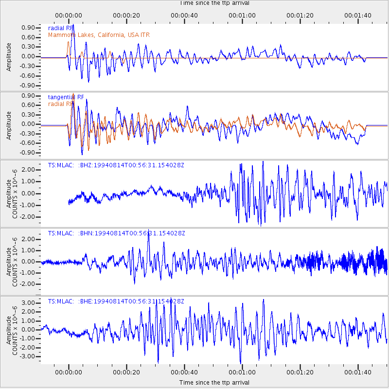
MLAC Mammoth Lakes, California, USA - Earthquake Result Viewer
*The percent match for this event was below the threshold and hence no stack was calculated.
| Earthquake location: |
East Of Kuril Islands |
| Earthquake latitude/longitude: |
44.7/150.1 |
| Earthquake time(UTC): |
1994/08/14 (226) 00:46:22 GMT |
| Earthquake Depth: |
33 km |
| Earthquake Magnitude: |
5.9 MB, 5.8 MS, 5.4 UNKNOWN, 6.1 MW |
| Earthquake Catalog/Contributor: |
WHDF/NEIC |
|
| Network: |
TS TERRAscope (Southern California Seismic Network) |
| Station: |
MLAC Mammoth Lakes, California, USA |
| Lat/Lon: |
37.63 N/118.83 W |
| Elevation: |
2170 m |
|
| Distance: |
65.4 deg |
| Az: |
60.78 deg |
| Baz: |
308.322 deg |
| Ray Param: |
$rayparam |
*The percent match for this event was below the threshold and hence was not used in the summary stack. |
|
| Radial Match: |
74.17622 % |
| Radial Bump: |
400 |
| Transverse Match: |
68.794044 % |
| Transverse Bump: |
400 |
| SOD ConfigId: |
4480 |
| Insert Time: |
2010-02-26 14:30:06.270 +0000 |
| GWidth: |
2.5 |
| Max Bumps: |
400 |
| Tol: |
0.001 |
|
Signal To Noise
| Channel | StoN | STA | LTA |
| TS:MLAC: :BHN:19940814T00:56:31.154028Z | 0.9913945 | 1.0475801E-7 | 1.0566732E-7 |
| TS:MLAC: :BHE:19940814T00:56:31.154028Z | 0.8692849 | 4.891851E-7 | 5.627443E-7 |
| TS:MLAC: :BHZ:19940814T00:56:31.154028Z | 1.7210941 | 4.8593614E-7 | 2.823414E-7 |
| Arrivals |
| Ps | |
| PpPs | |
| PsPs/PpSs | |


