You are here: Home > Network List > TA - USArray Transportable Network (new EarthScope stations) Stations List
> Station D10A Wagner Farm, Oakesdale, WA, USA > Earthquake Result Viewer
D10A Wagner Farm, Oakesdale, WA, USA - Earthquake Result Viewer

| Earthquake location: |
Fox Islands, Aleutian Islands |
| Earthquake latitude/longitude: |
52.5/-168.0 |
| Earthquake time(UTC): |
2007/07/15 (196) 13:08:00 GMT |
| Earthquake Depth: |
10 km |
| Earthquake Magnitude: |
5.8 MB, 5.9 MS, 6.1 MW, 6.0 MW |
| Earthquake Catalog/Contributor: |
WHDF/NEIC |
|
| Network: |
TA USArray Transportable Network (new EarthScope stations) |
| Station: |
D10A Wagner Farm, Oakesdale, WA, USA |
| Lat/Lon: |
47.05 N/117.28 W |
| Elevation: |
775 m |
|
| Distance: |
32.7 deg |
| Az: |
78.869 deg |
| Baz: |
298.635 deg |
| Ray Param: |
0.07855297 |
| Estimated Moho Depth: |
30.75 km |
| Estimated Crust Vp/Vs: |
1.72 |
| Assumed Crust Vp: |
6.571 km/s |
| Estimated Crust Vs: |
3.815 km/s |
| Estimated Crust Poisson's Ratio: |
0.25 |
|
| Radial Match: |
87.17534 % |
| Radial Bump: |
398 |
| Transverse Match: |
49.98338 % |
| Transverse Bump: |
400 |
| SOD ConfigId: |
2564 |
| Insert Time: |
2010-03-07 04:41:05.101 +0000 |
| GWidth: |
2.5 |
| Max Bumps: |
400 |
| Tol: |
0.001 |
|
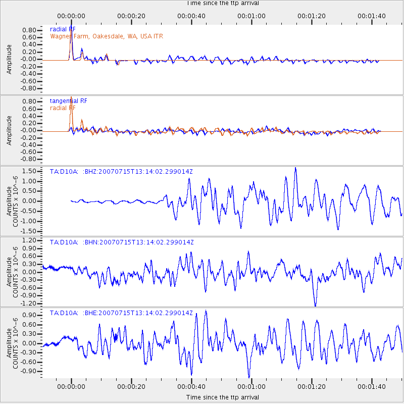
Signal To Noise
| Channel | StoN | STA | LTA |
| TA:D10A: :BHN:20070715T13:14:02.299014Z | 0.68303865 | 1.0735219E-7 | 1.5716854E-7 |
| TA:D10A: :BHE:20070715T13:14:02.299014Z | 1.7315325 | 2.0240536E-7 | 1.1689377E-7 |
| TA:D10A: :BHZ:20070715T13:14:02.299014Z | 6.7717156 | 3.3086292E-7 | 4.8859544E-8 |
| Arrivals |
| Ps | 3.7 SECOND |
| PpPs | 12 SECOND |
| PsPs/PpSs | 15 SECOND |


