
M13A Montello, NV, USA - Earthquake Result Viewer
| ||||||||||||||||||
| ||||||||||||||||||
| ||||||||||||||||||
|
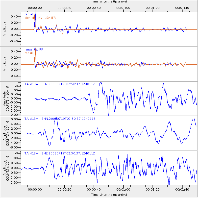
Signal To Noise
| Channel | StoN | STA | LTA |
| TA:M13A: :BHN:20080719T02:50:37.124011Z | 4.9350886 | 3.504975E-7 | 7.102152E-8 |
| TA:M13A: :BHE:20080719T02:50:37.124011Z | 1.15436 | 5.977676E-8 | 5.1783463E-8 |
| TA:M13A: :BHZ:20080719T02:50:37.124011Z | 1.1694512 | 9.109752E-8 | 7.789766E-8 |
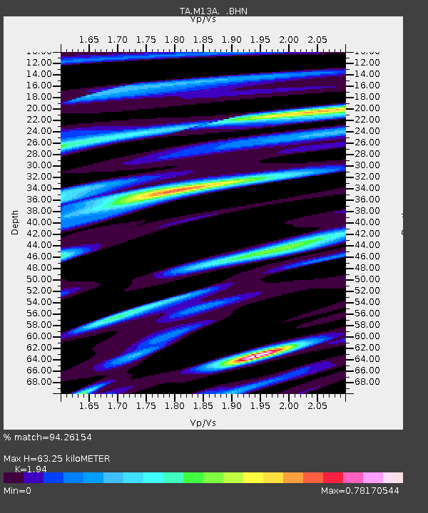
| Arrivals | |
| Ps | 9.7 SECOND |
| PpPs | 29 SECOND |
| PsPs/PpSs | 39 SECOND |

