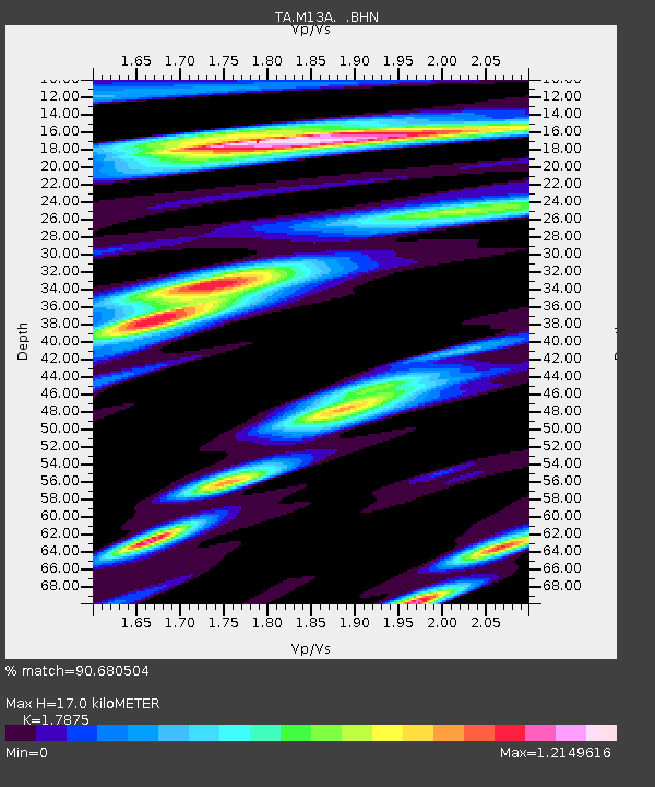
M13A Montello, NV, USA - Earthquake Result Viewer
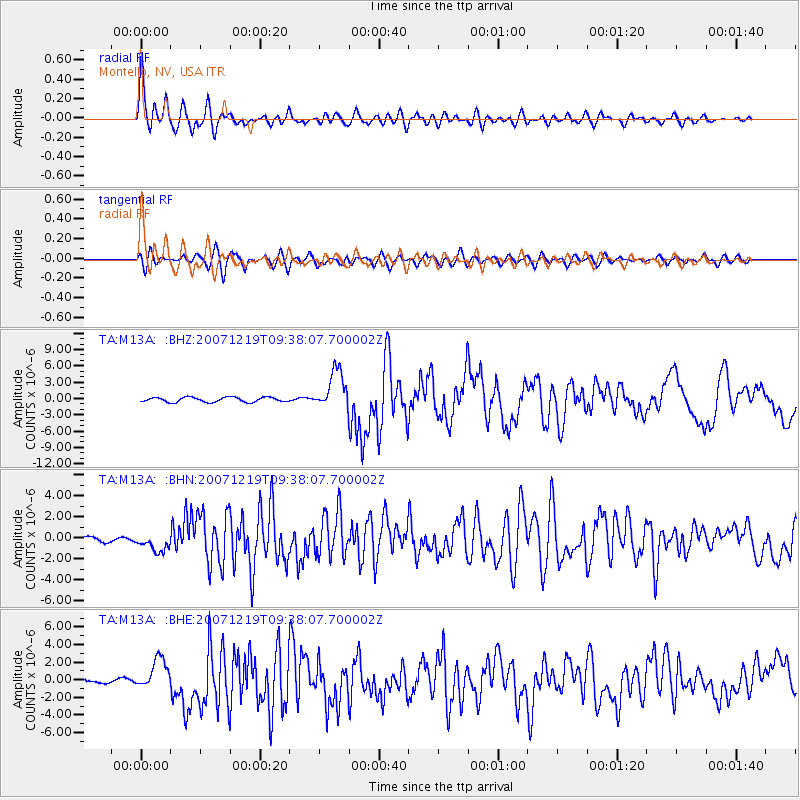
Earthquake location: Andreanof Islands, Aleutian Is.
Earthquake latitude/longitude: 51.4/-179.5
Earthquake time(UTC): 2007/12/19 (353) 09:30:27 GMT
Earthquake Depth: 29 km
Earthquake Magnitude: 6.4 MB, 7.1 MS, 7.1 MW, 7.0 MW
Earthquake Catalog/Contributor: WHDF/NEIC
Network: TA USArray Transportable Network (new EarthScope stations)
Station: M13A Montello, NV, USA
Lat/Lon: 41.36 N/114.17 W
Elevation: 1514 m
Distance: 44.8 deg
Az: 76.191 deg
Baz: 306.023 deg
Ray Param: 0.07164392
Estimated Moho Depth: 17.0 km
Estimated Crust Vp/Vs: 1.79
Assumed Crust Vp: 6.276 km/s
Estimated Crust Vs: 3.511 km/s
Estimated Crust Poisson's Ratio: 0.27
Radial Match: 90.680504 %
Radial Bump: 400
Transverse Match: 79.630325 %
Transverse Bump: 400
SOD ConfigId: 2564
Insert Time: 2010-03-07 04:44:35.022 +0000
GWidth: 2.5
Max Bumps: 400
Tol: 0.001

Signal To Noise

ChannelStoNSTALTA
TA:M13A: :BHN:20071219T09:38:07.700002Z3.81423438.4903286E-72.2259589E-7
TA:M13A: :BHE:20071219T09:38:07.700002Z4.6232871.7656627E-63.8190635E-7
TA:M13A: :BHZ:20071219T09:38:07.700002Z8.3178853.5973258E-64.3248076E-7
Arrivals
Ps2.3 SECOND
PpPs7.1 SECOND
PsPs/PpSs9.4 SECOND