M13A Montello, NV, USA - Earthquake Result Viewer
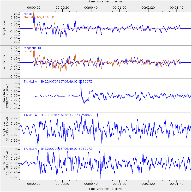
Earthquake location: Near West Coast Of Honshu, Japan
Earthquake latitude/longitude: 37.5/138.5
Earthquake time(UTC): 2007/07/16 (197) 06:37:40 GMT
Earthquake Depth: 15 km
Earthquake Magnitude: 5.7 MB, 5.1 MS, 5.7 MW, 5.6 MW
Earthquake Catalog/Contributor: WHDF/NEIC
Network: TA USArray Transportable Network (new EarthScope stations)
Station: M13A Montello, NV, USA
Lat/Lon: 41.36 N/114.17 W
Elevation: 1514 m
Distance: 77.3 deg
Az: 47.439 deg
Baz: 308.907 deg
Ray Param: 0.050426975
Estimated Moho Depth: 63.75 km
Estimated Crust Vp/Vs: 1.92
Assumed Crust Vp: 6.276 km/s
Estimated Crust Vs: 3.26 km/s
Estimated Crust Poisson's Ratio: 0.32
Radial Match: 80.02432 %
Radial Bump: 400
Transverse Match: 58.558193 %
Transverse Bump: 400
SOD ConfigId: 2564
Insert Time: 2010-03-07 04:45:04.322 +0000
GWidth: 2.5
Max Bumps: 400
Tol: 0.001

Signal To Noise

ChannelStoNSTALTA
TA:M13A: :BHN:20070716T06:49:02.625007Z2.53590081.2041592E-74.7484477E-8
TA:M13A: :BHE:20070716T06:49:02.625007Z2.49601241.2086417E-74.8422905E-8
TA:M13A: :BHZ:20070716T06:49:02.625007Z8.5426563.4086352E-73.9901348E-8
Arrivals
Ps9.7 SECOND
PpPs29 SECOND
PsPs/PpSs39 SECOND