M13A Montello, NV, USA - Earthquake Result Viewer
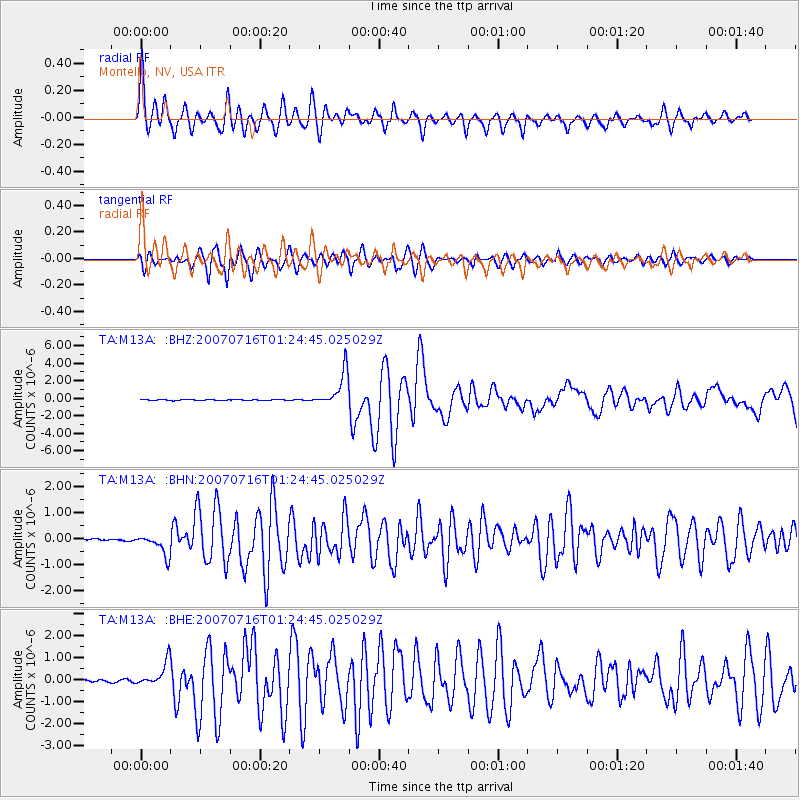
Earthquake location: Near West Coast Of Honshu, Japan
Earthquake latitude/longitude: 37.5/138.4
Earthquake time(UTC): 2007/07/16 (197) 01:13:22 GMT
Earthquake Depth: 12 km
Earthquake Magnitude: 6.5 MB, 6.4 MS, 6.6 MW, 6.5 MW
Earthquake Catalog/Contributor: WHDF/NEIC
Network: TA USArray Transportable Network (new EarthScope stations)
Station: M13A Montello, NV, USA
Lat/Lon: 41.36 N/114.17 W
Elevation: 1514 m
Distance: 77.3 deg
Az: 47.434 deg
Baz: 308.943 deg
Ray Param: 0.05043952
Estimated Moho Depth: 63.75 km
Estimated Crust Vp/Vs: 1.92
Assumed Crust Vp: 6.276 km/s
Estimated Crust Vs: 3.273 km/s
Estimated Crust Poisson's Ratio: 0.31
Radial Match: 93.80892 %
Radial Bump: 400
Transverse Match: 93.43513 %
Transverse Bump: 400
SOD ConfigId: 2564
Insert Time: 2010-03-07 04:45:05.755 +0000
GWidth: 2.5
Max Bumps: 400
Tol: 0.001

Signal To Noise

ChannelStoNSTALTA
TA:M13A: :BHN:20070716T01:24:45.025029Z6.8071013.943501E-75.793217E-8
TA:M13A: :BHE:20070716T01:24:45.025029Z14.8533815.3050826E-73.571633E-8
TA:M13A: :BHZ:20070716T01:24:45.025029Z40.9536251.9723802E-64.816131E-8
Arrivals
Ps9.6 SECOND
PpPs29 SECOND
PsPs/PpSs38 SECOND