You are here: Home > Network List > US - United States National Seismic Network Stations List
> Station HAWA Hanford, Washington, USA > Earthquake Result Viewer
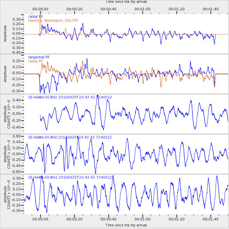
HAWA Hanford, Washington, USA - Earthquake Result Viewer
*The percent match for this event was below the threshold and hence no stack was calculated.
| Earthquake location: |
Near Coast Of Central Chile |
| Earthquake latitude/longitude: |
-29.9/-71.5 |
| Earthquake time(UTC): |
2019/09/26 (269) 20:31:30 GMT |
| Earthquake Depth: |
37 km |
| Earthquake Magnitude: |
5.4 Mww |
| Earthquake Catalog/Contributor: |
NEIC PDE/us |
|
| Network: |
US United States National Seismic Network |
| Station: |
HAWA Hanford, Washington, USA |
| Lat/Lon: |
46.39 N/119.53 W |
| Elevation: |
364 m |
|
| Distance: |
87.5 deg |
| Az: |
328.968 deg |
| Baz: |
139.684 deg |
| Ray Param: |
$rayparam |
*The percent match for this event was below the threshold and hence was not used in the summary stack. |
|
| Radial Match: |
51.147003 % |
| Radial Bump: |
400 |
| Transverse Match: |
63.36585 % |
| Transverse Bump: |
400 |
| SOD ConfigId: |
19053131 |
| Insert Time: |
2019-10-10 20:40:33.342 +0000 |
| GWidth: |
2.5 |
| Max Bumps: |
400 |
| Tol: |
0.001 |
|
Signal To Noise
| Channel | StoN | STA | LTA |
| US:HAWA:00:BHZ:20190926T20:43:42.724001Z | 1.5786412 | 2.9229327E-7 | 1.8515497E-7 |
| US:HAWA:00:BH1:20190926T20:43:42.724001Z | 1.5877942 | 2.2671098E-7 | 1.427836E-7 |
| US:HAWA:00:BH2:20190926T20:43:42.724001Z | 1.7873958 | 3.0959347E-7 | 1.7320924E-7 |
| Arrivals |
| Ps | |
| PpPs | |
| PsPs/PpSs | |


