M13A Montello, NV, USA - Earthquake Result Viewer
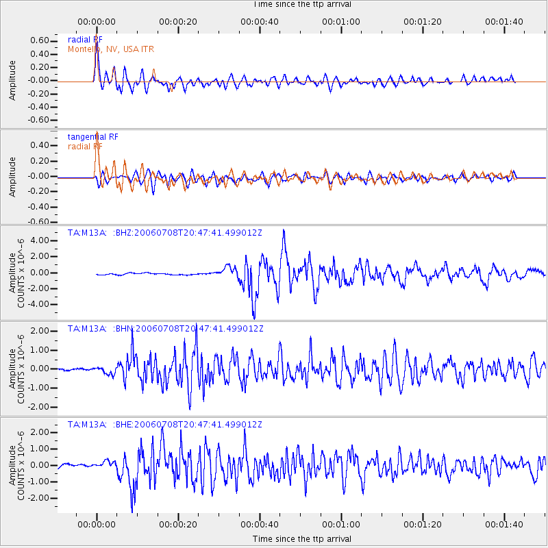
Earthquake location: Andreanof Islands, Aleutian Is.
Earthquake latitude/longitude: 51.2/-179.3
Earthquake time(UTC): 2006/07/08 (189) 20:40:00 GMT
Earthquake Depth: 22 km
Earthquake Magnitude: 6.2 MB, 6.4 MS, 6.6 MW, 6.6 MW
Earthquake Catalog/Contributor: WHDF/NEIC
Network: TA USArray Transportable Network (new EarthScope stations)
Station: M13A Montello, NV, USA
Lat/Lon: 41.36 N/114.17 W
Elevation: 1514 m
Distance: 44.7 deg
Az: 76.176 deg
Baz: 305.773 deg
Ray Param: 0.07172252
Estimated Moho Depth: 33.25 km
Estimated Crust Vp/Vs: 1.75
Assumed Crust Vp: 6.276 km/s
Estimated Crust Vs: 3.586 km/s
Estimated Crust Poisson's Ratio: 0.26
Radial Match: 90.410904 %
Radial Bump: 400
Transverse Match: 80.21418 %
Transverse Bump: 400
SOD ConfigId: 2665
Insert Time: 2010-03-07 04:45:45.176 +0000
GWidth: 2.5
Max Bumps: 400
Tol: 0.001

Signal To Noise

ChannelStoNSTALTA
TA:M13A: :BHN:20060708T20:47:41.499012Z2.52098271.7203574E-76.824154E-8
TA:M13A: :BHE:20060708T20:47:41.499012Z2.77833912.6196713E-79.428911E-8
TA:M13A: :BHZ:20060708T20:47:41.499012Z6.7695736.988249E-71.0323028E-7
Arrivals
Ps4.2 SECOND
PpPs14 SECOND
PsPs/PpSs18 SECOND