M13A Montello, NV, USA - Earthquake Result Viewer
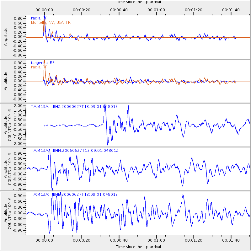
Earthquake location: Off Coast Of Chiapas, Mexico
Earthquake latitude/longitude: 15.0/-94.2
Earthquake time(UTC): 2006/06/27 (178) 13:03:12 GMT
Earthquake Depth: 29 km
Earthquake Magnitude: 5.4 MB, 5.5 MS, 5.8 MW, 5.8 MW
Earthquake Catalog/Contributor: WHDF/NEIC
Network: TA USArray Transportable Network (new EarthScope stations)
Station: M13A Montello, NV, USA
Lat/Lon: 41.36 N/114.17 W
Elevation: 1514 m
Distance: 31.5 deg
Az: 330.502 deg
Baz: 140.786 deg
Ray Param: 0.07900985
Estimated Moho Depth: 14.25 km
Estimated Crust Vp/Vs: 2.10
Assumed Crust Vp: 6.276 km/s
Estimated Crust Vs: 2.992 km/s
Estimated Crust Poisson's Ratio: 0.35
Radial Match: 91.77983 %
Radial Bump: 352
Transverse Match: 83.85313 %
Transverse Bump: 400
SOD ConfigId: 2665
Insert Time: 2010-03-07 04:45:48.249 +0000
GWidth: 2.5
Max Bumps: 400
Tol: 0.001

Signal To Noise

ChannelStoNSTALTA
TA:M13A: :BHN:20060627T13:09:01.04801Z9.4585766.3331544E-76.6956744E-8
TA:M13A: :BHE:20060627T13:09:01.04801Z8.2918675.378541E-76.4865255E-8
TA:M13A: :BHZ:20060627T13:09:01.04801Z19.7342821.1192883E-65.671797E-8
Arrivals
Ps2.7 SECOND
PpPs6.6 SECOND
PsPs/PpSs9.3 SECOND