You are here: Home > Network List > AV - Alaska Volcano Observatory Stations List
> Station SPCR Ckakachatna River, Mount Spurr, Alaska > Earthquake Result Viewer
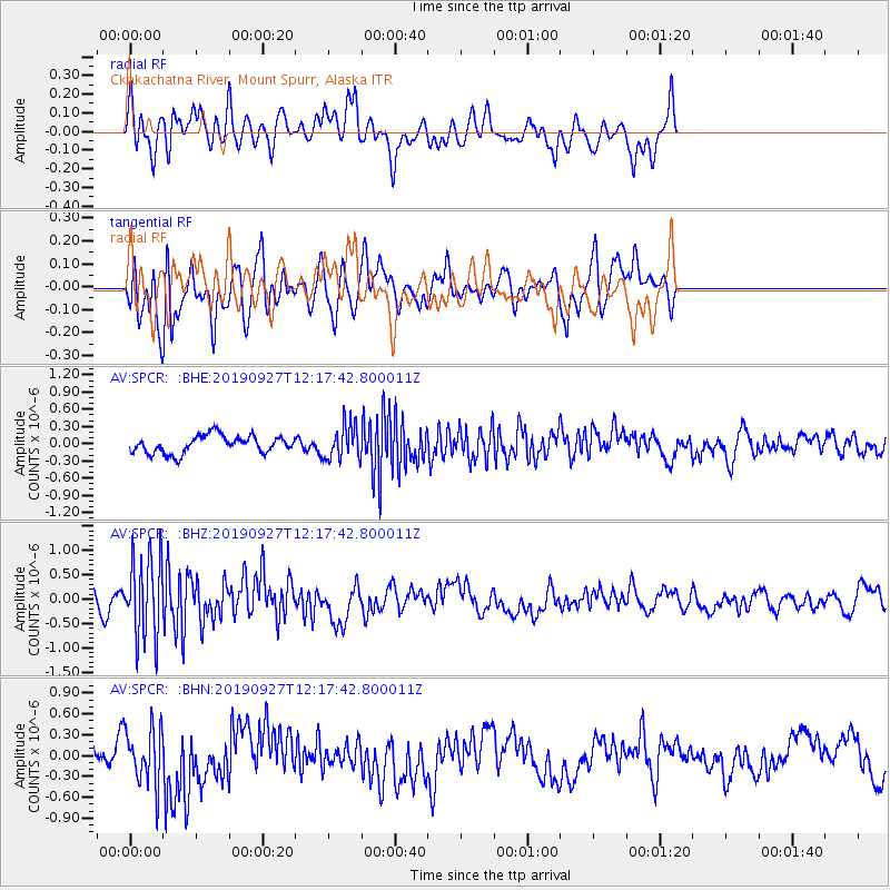
SPCR Ckakachatna River, Mount Spurr, Alaska - Earthquake Result Viewer
*The percent match for this event was below the threshold and hence no stack was calculated.
| Earthquake location: |
Kermadec Islands, New Zealand |
| Earthquake latitude/longitude: |
-30.1/-177.8 |
| Earthquake time(UTC): |
2019/09/27 (270) 12:05:02 GMT |
| Earthquake Depth: |
35 km |
| Earthquake Magnitude: |
6.0 Mww |
| Earthquake Catalog/Contributor: |
NEIC PDE/us |
|
| Network: |
AV Alaska Volcano Observatory |
| Station: |
SPCR Ckakachatna River, Mount Spurr, Alaska |
| Lat/Lon: |
61.20 N/152.21 W |
| Elevation: |
984 m |
|
| Distance: |
93.4 deg |
| Az: |
12.106 deg |
| Baz: |
202.038 deg |
| Ray Param: |
$rayparam |
*The percent match for this event was below the threshold and hence was not used in the summary stack. |
|
| Radial Match: |
53.378174 % |
| Radial Bump: |
400 |
| Transverse Match: |
67.680855 % |
| Transverse Bump: |
400 |
| SOD ConfigId: |
19053131 |
| Insert Time: |
2019-10-11 12:10:04.979 +0000 |
| GWidth: |
2.5 |
| Max Bumps: |
400 |
| Tol: |
0.001 |
|
Signal To Noise
| Channel | StoN | STA | LTA |
| AV:SPCR: :BHZ:20190927T12:17:42.800011Z | 4.093995 | 8.4126503E-7 | 2.0548754E-7 |
| AV:SPCR: :BHN:20190927T12:17:42.800011Z | 2.024175 | 4.032498E-7 | 1.9921687E-7 |
| AV:SPCR: :BHE:20190927T12:17:42.800011Z | 1.9275568 | 2.969706E-7 | 1.5406582E-7 |
| Arrivals |
| Ps | |
| PpPs | |
| PsPs/PpSs | |


