You are here: Home > Network List > G - GEOSCOPE Stations List
> Station MPG Montagne des Peres, French Guyana > Earthquake Result Viewer
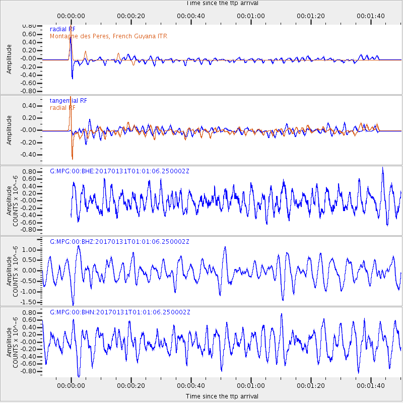
MPG Montagne des Peres, French Guyana - Earthquake Result Viewer
*The percent match for this event was below the threshold and hence no stack was calculated.
| Earthquake location: |
Northern Mid-Atlantic Ridge |
| Earthquake latitude/longitude: |
34.6/-36.4 |
| Earthquake time(UTC): |
2017/01/31 (031) 00:55:02 GMT |
| Earthquake Depth: |
10 km |
| Earthquake Magnitude: |
5.6 Mwc |
| Earthquake Catalog/Contributor: |
NEIC PDE/us |
|
| Network: |
G GEOSCOPE |
| Station: |
MPG Montagne des Peres, French Guyana |
| Lat/Lon: |
5.11 N/52.64 W |
| Elevation: |
147 m |
|
| Distance: |
33.0 deg |
| Az: |
210.703 deg |
| Baz: |
25.009 deg |
| Ray Param: |
$rayparam |
*The percent match for this event was below the threshold and hence was not used in the summary stack. |
|
| Radial Match: |
61.648006 % |
| Radial Bump: |
400 |
| Transverse Match: |
52.981968 % |
| Transverse Bump: |
400 |
| SOD ConfigId: |
1943534 |
| Insert Time: |
2017-02-14 00:56:07.218 +0000 |
| GWidth: |
2.5 |
| Max Bumps: |
400 |
| Tol: |
0.001 |
|
Signal To Noise
| Channel | StoN | STA | LTA |
| G:MPG:00:BHZ:20170131T01:01:06.250002Z | 2.389718 | 8.006349E-7 | 3.350332E-7 |
| G:MPG:00:BHN:20170131T01:01:06.250002Z | 1.5543045 | 4.250319E-7 | 2.7345473E-7 |
| G:MPG:00:BHE:20170131T01:01:06.250002Z | 0.9398825 | 2.3082245E-7 | 2.4558648E-7 |
| Arrivals |
| Ps | |
| PpPs | |
| PsPs/PpSs | |


