You are here: Home > Network List > US - United States National Seismic Network Stations List
> Station ERPA Erie, Pennsylvania, USA > Earthquake Result Viewer
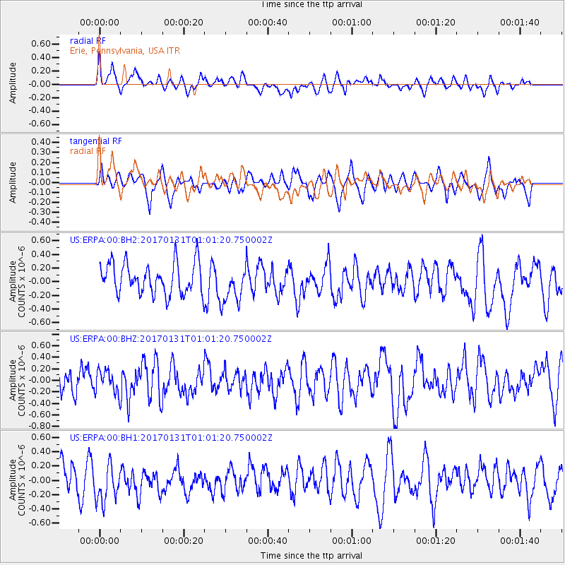
ERPA Erie, Pennsylvania, USA - Earthquake Result Viewer
*The percent match for this event was below the threshold and hence no stack was calculated.
| Earthquake location: |
Northern Mid-Atlantic Ridge |
| Earthquake latitude/longitude: |
34.6/-36.4 |
| Earthquake time(UTC): |
2017/01/31 (031) 00:55:02 GMT |
| Earthquake Depth: |
10 km |
| Earthquake Magnitude: |
5.6 Mwc |
| Earthquake Catalog/Contributor: |
NEIC PDE/us |
|
| Network: |
US United States National Seismic Network |
| Station: |
ERPA Erie, Pennsylvania, USA |
| Lat/Lon: |
42.12 N/79.99 W |
| Elevation: |
306 m |
|
| Distance: |
34.7 deg |
| Az: |
295.646 deg |
| Baz: |
87.851 deg |
| Ray Param: |
$rayparam |
*The percent match for this event was below the threshold and hence was not used in the summary stack. |
|
| Radial Match: |
47.61801 % |
| Radial Bump: |
400 |
| Transverse Match: |
62.254032 % |
| Transverse Bump: |
400 |
| SOD ConfigId: |
1943534 |
| Insert Time: |
2017-02-14 00:58:35.743 +0000 |
| GWidth: |
2.5 |
| Max Bumps: |
400 |
| Tol: |
0.001 |
|
Signal To Noise
| Channel | StoN | STA | LTA |
| US:ERPA:00:BHZ:20170131T01:01:20.750002Z | 0.99258524 | 2.0021871E-7 | 2.0171437E-7 |
| US:ERPA:00:BH1:20170131T01:01:20.750002Z | 1.2192283 | 2.7155457E-7 | 2.2272658E-7 |
| US:ERPA:00:BH2:20170131T01:01:20.750002Z | 1.1951079 | 2.7260901E-7 | 2.2810411E-7 |
| Arrivals |
| Ps | |
| PpPs | |
| PsPs/PpSs | |


