You are here: Home > Network List > IU - Global Seismograph Network (GSN - IRIS/USGS) Stations List
> Station PMG Port Moresby, New Guinea > Earthquake Result Viewer
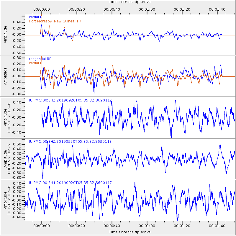
PMG Port Moresby, New Guinea - Earthquake Result Viewer
*The percent match for this event was below the threshold and hence no stack was calculated.
| Earthquake location: |
Tonga Islands Region |
| Earthquake latitude/longitude: |
-18.3/-172.1 |
| Earthquake time(UTC): |
2019/09/20 (263) 05:28:25 GMT |
| Earthquake Depth: |
10 km |
| Earthquake Magnitude: |
5.1 Mww |
| Earthquake Catalog/Contributor: |
NEIC PDE/us |
|
| Network: |
IU Global Seismograph Network (GSN - IRIS/USGS) |
| Station: |
PMG Port Moresby, New Guinea |
| Lat/Lon: |
9.40 S/147.16 E |
| Elevation: |
90 m |
|
| Distance: |
40.4 deg |
| Az: |
276.95 deg |
| Baz: |
107.061 deg |
| Ray Param: |
$rayparam |
*The percent match for this event was below the threshold and hence was not used in the summary stack. |
|
| Radial Match: |
39.56961 % |
| Radial Bump: |
400 |
| Transverse Match: |
50.58634 % |
| Transverse Bump: |
400 |
| SOD ConfigId: |
19053131 |
| Insert Time: |
2019-10-11 12:42:27.858 +0000 |
| GWidth: |
2.5 |
| Max Bumps: |
400 |
| Tol: |
0.001 |
|
Signal To Noise
| Channel | StoN | STA | LTA |
| IU:PMG:00:BHZ:20190920T05:35:32.869011Z | 2.1971002 | 4.0097507E-7 | 1.8250196E-7 |
| IU:PMG:00:BH1:20190920T05:35:32.869011Z | 1.0246804 | 1.7529345E-7 | 1.7107135E-7 |
| IU:PMG:00:BH2:20190920T05:35:32.869011Z | 1.0438805 | 1.6019047E-7 | 1.5345672E-7 |
| Arrivals |
| Ps | |
| PpPs | |
| PsPs/PpSs | |


