You are here: Home > Network List > GS - US Geological Survey Networks Stations List
> Station KAN13 Rinehart Farm > Earthquake Result Viewer
KAN13 Rinehart Farm - Earthquake Result Viewer
*The percent match for this event was below the threshold and hence no stack was calculated.
| Earthquake location: |
Near Coast Of Ecuador |
| Earthquake latitude/longitude: |
0.7/-79.7 |
| Earthquake time(UTC): |
2017/01/31 (031) 14:22:40 GMT |
| Earthquake Depth: |
21 km |
| Earthquake Magnitude: |
5.5 Mww |
| Earthquake Catalog/Contributor: |
NEIC PDE/us |
|
| Network: |
GS US Geological Survey Networks |
| Station: |
KAN13 Rinehart Farm |
| Lat/Lon: |
37.01 N/97.48 W |
| Elevation: |
340 m |
|
| Distance: |
39.7 deg |
| Az: |
337.475 deg |
| Baz: |
151.409 deg |
| Ray Param: |
$rayparam |
*The percent match for this event was below the threshold and hence was not used in the summary stack. |
|
| Radial Match: |
30.589382 % |
| Radial Bump: |
400 |
| Transverse Match: |
30.55641 % |
| Transverse Bump: |
400 |
| SOD ConfigId: |
1943534 |
| Insert Time: |
2017-02-14 14:27:24.686 +0000 |
| GWidth: |
2.5 |
| Max Bumps: |
400 |
| Tol: |
0.001 |
|
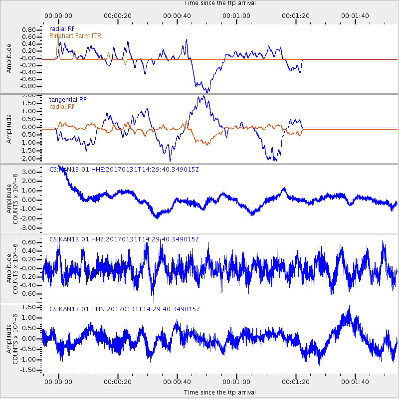
Signal To Noise
| Channel | StoN | STA | LTA |
| GS:KAN13:01:HHZ:20170131T14:29:40.349015Z | 0.7663278 | 2.5034527E-7 | 3.2668171E-7 |
| GS:KAN13:01:HHN:20170131T14:29:40.349015Z | 1.0682428 | 4.5723223E-7 | 4.2802273E-7 |
| GS:KAN13:01:HHE:20170131T14:29:40.349015Z | 2.223609 | 2.1480955E-6 | 9.660401E-7 |
| Arrivals |
| Ps | |
| PpPs | |
| PsPs/PpSs | |


