You are here: Home > Network List > TS - TERRAscope (Southern California Seismic Network) Stations List
> Station NEE Needles, California, USA > Earthquake Result Viewer
NEE Needles, California, USA - Earthquake Result Viewer

| Earthquake location: |
Southeast Of Loyalty Islands |
| Earthquake latitude/longitude: |
-23.0/169.9 |
| Earthquake time(UTC): |
1995/05/16 (136) 20:12:45 GMT |
| Earthquake Depth: |
33 km |
| Earthquake Magnitude: |
6.8 MB, 7.7 MS, 7.7 UNKNOWN, 7.7 MW |
| Earthquake Catalog/Contributor: |
WHDF/NEIC |
|
| Network: |
TS TERRAscope (Southern California Seismic Network) |
| Station: |
NEE Needles, California, USA |
| Lat/Lon: |
34.82 N/114.60 W |
| Elevation: |
139 m |
|
| Distance: |
91.8 deg |
| Az: |
52.839 deg |
| Baz: |
243.187 deg |
| Ray Param: |
0.041547153 |
| Estimated Moho Depth: |
10.0 km |
| Estimated Crust Vp/Vs: |
1.62 |
| Assumed Crust Vp: |
6.276 km/s |
| Estimated Crust Vs: |
3.868 km/s |
| Estimated Crust Poisson's Ratio: |
0.19 |
|
| Radial Match: |
92.54362 % |
| Radial Bump: |
400 |
| Transverse Match: |
86.88801 % |
| Transverse Bump: |
400 |
| SOD ConfigId: |
6273 |
| Insert Time: |
2010-02-26 14:30:33.978 +0000 |
| GWidth: |
2.5 |
| Max Bumps: |
400 |
| Tol: |
0.001 |
|
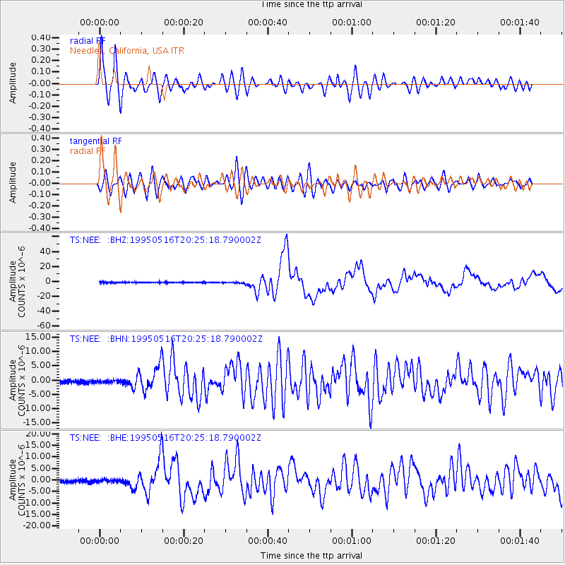
Signal To Noise
| Channel | StoN | STA | LTA |
| TS:NEE: :BHN:19950516T20:25:18.790002Z | 0.8622537 | 4.8423607E-7 | 5.615934E-7 |
| TS:NEE: :BHE:19950516T20:25:18.790002Z | 0.928804 | 5.02916E-7 | 5.4146625E-7 |
| TS:NEE: :BHZ:19950516T20:25:18.790002Z | 1.6445895 | 9.525805E-7 | 5.792208E-7 |
| Arrivals |
| Ps | 1.0 SECOND |
| PpPs | 4.1 SECOND |
| PsPs/PpSs | 5.1 SECOND |


