You are here: Home > Network List > TA - USArray Transportable Network (new EarthScope stations) Stations List
> Station T12A Moapa, NV, USA > Earthquake Result Viewer
T12A Moapa, NV, USA - Earthquake Result Viewer

| Earthquake location: |
Sea Of Japan |
| Earthquake latitude/longitude: |
36.8/134.9 |
| Earthquake time(UTC): |
2007/07/16 (197) 14:17:37 GMT |
| Earthquake Depth: |
350 km |
| Earthquake Magnitude: |
6.2 MB, 6.8 MW, 6.8 MW |
| Earthquake Catalog/Contributor: |
WHDF/NEIC |
|
| Network: |
TA USArray Transportable Network (new EarthScope stations) |
| Station: |
T12A Moapa, NV, USA |
| Lat/Lon: |
36.73 N/114.71 W |
| Elevation: |
538 m |
|
| Distance: |
82.5 deg |
| Az: |
49.404 deg |
| Baz: |
310.667 deg |
| Ray Param: |
0.045895517 |
| Estimated Moho Depth: |
31.75 km |
| Estimated Crust Vp/Vs: |
1.70 |
| Assumed Crust Vp: |
6.276 km/s |
| Estimated Crust Vs: |
3.703 km/s |
| Estimated Crust Poisson's Ratio: |
0.23 |
|
| Radial Match: |
85.269844 % |
| Radial Bump: |
400 |
| Transverse Match: |
68.18605 % |
| Transverse Bump: |
400 |
| SOD ConfigId: |
2564 |
| Insert Time: |
2010-03-07 04:50:28.357 +0000 |
| GWidth: |
2.5 |
| Max Bumps: |
400 |
| Tol: |
0.001 |
|
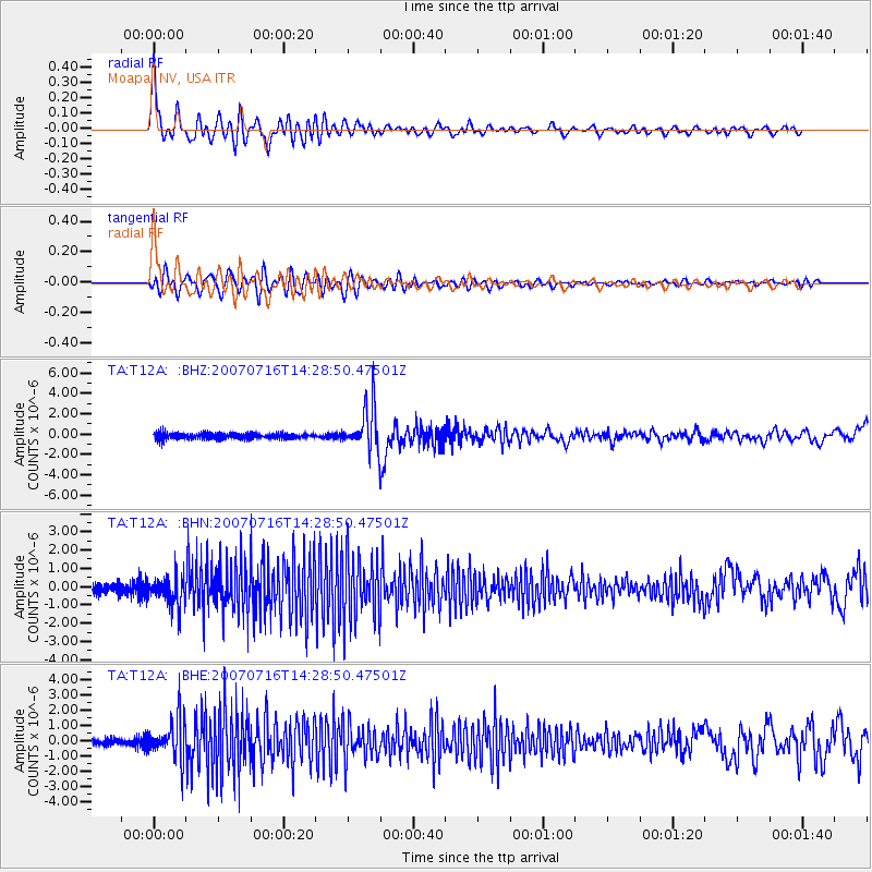
Signal To Noise
| Channel | StoN | STA | LTA |
| TA:T12A: :BHN:20070716T14:28:50.47501Z | 1.8271385 | 8.192627E-7 | 4.4838566E-7 |
| TA:T12A: :BHE:20070716T14:28:50.47501Z | 4.1084003 | 1.3282997E-6 | 3.233131E-7 |
| TA:T12A: :BHZ:20070716T14:28:50.47501Z | 7.2441797 | 2.1443234E-6 | 2.9600636E-7 |
| Arrivals |
| Ps | 3.6 SECOND |
| PpPs | 13 SECOND |
| PsPs/PpSs | 17 SECOND |


