You are here: Home > Network List > TA - USArray Transportable Network (new EarthScope stations) Stations List
> Station H31M Peel River, Yukon, CAN > Earthquake Result Viewer
H31M Peel River, Yukon, CAN - Earthquake Result Viewer

| Earthquake location: |
Mindanao, Philippines |
| Earthquake latitude/longitude: |
5.7/126.5 |
| Earthquake time(UTC): |
2019/09/29 (272) 02:02:52 GMT |
| Earthquake Depth: |
76 km |
| Earthquake Magnitude: |
6.2 Mww |
| Earthquake Catalog/Contributor: |
NEIC PDE/us |
|
| Network: |
TA USArray Transportable Network (new EarthScope stations) |
| Station: |
H31M Peel River, Yukon, CAN |
| Lat/Lon: |
65.81 N/134.34 W |
| Elevation: |
642 m |
|
| Distance: |
88.6 deg |
| Az: |
24.02 deg |
| Baz: |
280.614 deg |
| Ray Param: |
0.04233246 |
| Estimated Moho Depth: |
42.25 km |
| Estimated Crust Vp/Vs: |
1.94 |
| Assumed Crust Vp: |
6.419 km/s |
| Estimated Crust Vs: |
3.313 km/s |
| Estimated Crust Poisson's Ratio: |
0.32 |
|
| Radial Match: |
85.53338 % |
| Radial Bump: |
400 |
| Transverse Match: |
76.08833 % |
| Transverse Bump: |
400 |
| SOD ConfigId: |
19053131 |
| Insert Time: |
2019-10-13 02:11:34.092 +0000 |
| GWidth: |
2.5 |
| Max Bumps: |
400 |
| Tol: |
0.001 |
|
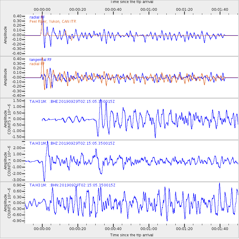
Signal To Noise
| Channel | StoN | STA | LTA |
| TA:H31M: :BHZ:20190929T02:15:05.350015Z | 21.356354 | 1.6555791E-6 | 7.752162E-8 |
| TA:H31M: :BHN:20190929T02:15:05.350015Z | 1.8232261 | 1.8824225E-7 | 1.03246805E-7 |
| TA:H31M: :BHE:20190929T02:15:05.350015Z | 7.356049 | 8.490268E-7 | 1.1541886E-7 |
| Arrivals |
| Ps | 6.3 SECOND |
| PpPs | 19 SECOND |
| PsPs/PpSs | 25 SECOND |


