T12A Moapa, NV, USA - Earthquake Result Viewer
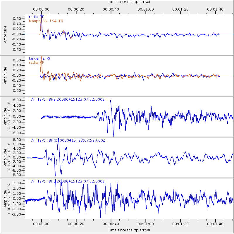
Earthquake location: Andreanof Islands, Aleutian Is.
Earthquake latitude/longitude: 51.9/-179.4
Earthquake time(UTC): 2008/04/15 (106) 22:59:51 GMT
Earthquake Depth: 10 km
Earthquake Magnitude: 6.1 MB, 6.4 MS, 6.4 MW, 6.4 MW
Earthquake Catalog/Contributor: WHDF/NEIC
Network: TA USArray Transportable Network (new EarthScope stations)
Station: T12A Moapa, NV, USA
Lat/Lon: 36.73 N/114.71 W
Elevation: 538 m
Distance: 47.1 deg
Az: 82.205 deg
Baz: 310.106 deg
Ray Param: 0.07020074
Estimated Moho Depth: 22.25 km
Estimated Crust Vp/Vs: 2.10
Assumed Crust Vp: 6.276 km/s
Estimated Crust Vs: 2.996 km/s
Estimated Crust Poisson's Ratio: 0.35
Radial Match: 93.356255 %
Radial Bump: 400
Transverse Match: 76.665016 %
Transverse Bump: 400
SOD ConfigId: 2504
Insert Time: 2010-03-07 04:50:39.552 +0000
GWidth: 2.5
Max Bumps: 400
Tol: 0.001

Signal To Noise

ChannelStoNSTALTA
TA:T12A: :BHN:20080415T23:07:52.600Z16.811651.5740151E-69.362645E-8
TA:T12A: :BHE:20080415T23:07:52.600Z3.63404975.883811E-71.6190783E-7
TA:T12A: :BHZ:20080415T23:07:52.600Z4.3911886.9568887E-71.5842839E-7
Arrivals
Ps4.1 SECOND
PpPs10 SECOND
PsPs/PpSs15 SECOND