You are here: Home > Network List > US - United States National Seismic Network Stations List
> Station AMTX Amarillo, Texas, USA > Earthquake Result Viewer
AMTX Amarillo, Texas, USA - Earthquake Result Viewer
*The percent match for this event was below the threshold and hence no stack was calculated.
| Earthquake location: |
Leeward Islands |
| Earthquake latitude/longitude: |
15.1/-60.5 |
| Earthquake time(UTC): |
2017/02/03 (034) 19:54:21 GMT |
| Earthquake Depth: |
35 km |
| Earthquake Magnitude: |
5.6 Mwb |
| Earthquake Catalog/Contributor: |
NEIC PDE/us |
|
| Network: |
US United States National Seismic Network |
| Station: |
AMTX Amarillo, Texas, USA |
| Lat/Lon: |
34.53 N/101.41 W |
| Elevation: |
1010 m |
|
| Distance: |
41.5 deg |
| Az: |
305.359 deg |
| Baz: |
107.411 deg |
| Ray Param: |
$rayparam |
*The percent match for this event was below the threshold and hence was not used in the summary stack. |
|
| Radial Match: |
57.44588 % |
| Radial Bump: |
400 |
| Transverse Match: |
60.48641 % |
| Transverse Bump: |
400 |
| SOD ConfigId: |
1943534 |
| Insert Time: |
2017-02-17 20:10:43.969 +0000 |
| GWidth: |
2.5 |
| Max Bumps: |
400 |
| Tol: |
0.001 |
|
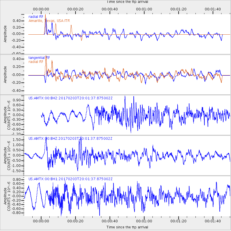
Signal To Noise
| Channel | StoN | STA | LTA |
| US:AMTX:00:BHZ:20170203T20:01:37.875002Z | 3.6289403 | 7.3213596E-7 | 2.0174924E-7 |
| US:AMTX:00:BH1:20170203T20:01:37.875002Z | 1.4857695 | 3.0903803E-7 | 2.0799864E-7 |
| US:AMTX:00:BH2:20170203T20:01:37.875002Z | 2.0245152 | 4.6695428E-7 | 2.3064993E-7 |
| Arrivals |
| Ps | |
| PpPs | |
| PsPs/PpSs | |


