
Q11A Duckwater, NV, USA - Earthquake Result Viewer
| ||||||||||||||||||
| ||||||||||||||||||
| ||||||||||||||||||
|
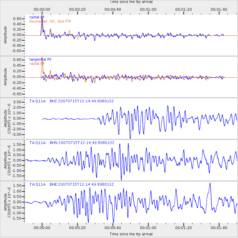
Signal To Noise
| Channel | StoN | STA | LTA |
| TA:Q11A: :BHN:20070715T13:14:49.898013Z | 2.4745739 | 9.7841045E-8 | 3.9538545E-8 |
| TA:Q11A: :BHE:20070715T13:14:49.898013Z | 4.476771 | 1.5967994E-7 | 3.5668556E-8 |
| TA:Q11A: :BHZ:20070715T13:14:49.898013Z | 6.0763083 | 3.5666673E-7 | 5.8697932E-8 |
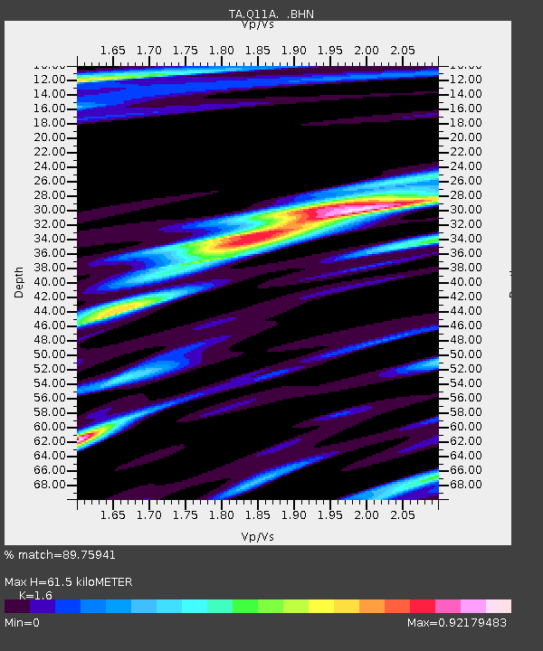
| Arrivals | |
| Ps | 6.3 SECOND |
| PpPs | 24 SECOND |
| PsPs/PpSs | 30 SECOND |

