You are here: Home > Network List > US - United States National Seismic Network Stations List
> Station WMOK Wichita Mountains, Oklahoma, USA > Earthquake Result Viewer
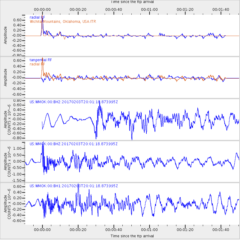
WMOK Wichita Mountains, Oklahoma, USA - Earthquake Result Viewer
*The percent match for this event was below the threshold and hence no stack was calculated.
| Earthquake location: |
Leeward Islands |
| Earthquake latitude/longitude: |
15.1/-60.5 |
| Earthquake time(UTC): |
2017/02/03 (034) 19:54:21 GMT |
| Earthquake Depth: |
35 km |
| Earthquake Magnitude: |
5.6 Mwb |
| Earthquake Catalog/Contributor: |
NEIC PDE/us |
|
| Network: |
US United States National Seismic Network |
| Station: |
WMOK Wichita Mountains, Oklahoma, USA |
| Lat/Lon: |
34.74 N/98.78 W |
| Elevation: |
486 m |
|
| Distance: |
39.5 deg |
| Az: |
306.729 deg |
| Baz: |
109.939 deg |
| Ray Param: |
$rayparam |
*The percent match for this event was below the threshold and hence was not used in the summary stack. |
|
| Radial Match: |
48.795326 % |
| Radial Bump: |
348 |
| Transverse Match: |
48.576775 % |
| Transverse Bump: |
400 |
| SOD ConfigId: |
1943534 |
| Insert Time: |
2017-02-17 20:15:23.834 +0000 |
| GWidth: |
2.5 |
| Max Bumps: |
400 |
| Tol: |
0.001 |
|
Signal To Noise
| Channel | StoN | STA | LTA |
| US:WMOK:00:BHZ:20170203T20:01:18.873995Z | 3.230299 | 5.807839E-7 | 1.7979261E-7 |
| US:WMOK:00:BH1:20170203T20:01:18.873995Z | 1.9007734 | 1.91922E-7 | 1.0097048E-7 |
| US:WMOK:00:BH2:20170203T20:01:18.873995Z | 2.8736322 | 4.3006384E-7 | 1.4965863E-7 |
| Arrivals |
| Ps | |
| PpPs | |
| PsPs/PpSs | |


