You are here: Home > Network List > WY - Yellowstone Wyoming Seismic Network Stations List
> Station YUF Upper Falls, WY, USA > Earthquake Result Viewer
YUF Upper Falls, WY, USA - Earthquake Result Viewer
*The percent match for this event was below the threshold and hence no stack was calculated.
| Earthquake location: |
Leeward Islands |
| Earthquake latitude/longitude: |
15.1/-60.5 |
| Earthquake time(UTC): |
2017/02/03 (034) 19:54:21 GMT |
| Earthquake Depth: |
35 km |
| Earthquake Magnitude: |
5.6 Mwb |
| Earthquake Catalog/Contributor: |
NEIC PDE/us |
|
| Network: |
WY Yellowstone Wyoming Seismic Network |
| Station: |
YUF Upper Falls, WY, USA |
| Lat/Lon: |
44.71 N/110.51 W |
| Elevation: |
2394 m |
|
| Distance: |
51.4 deg |
| Az: |
315.647 deg |
| Baz: |
108.723 deg |
| Ray Param: |
$rayparam |
*The percent match for this event was below the threshold and hence was not used in the summary stack. |
|
| Radial Match: |
48.34133 % |
| Radial Bump: |
400 |
| Transverse Match: |
46.187817 % |
| Transverse Bump: |
393 |
| SOD ConfigId: |
1943534 |
| Insert Time: |
2017-02-17 20:20:38.235 +0000 |
| GWidth: |
2.5 |
| Max Bumps: |
400 |
| Tol: |
0.001 |
|
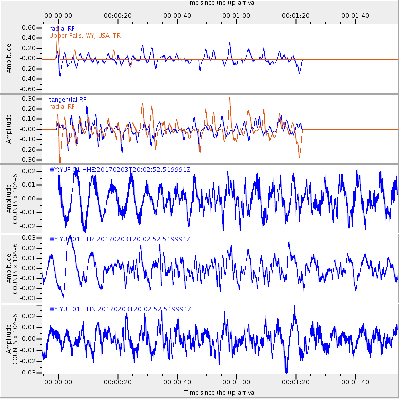
Signal To Noise
| Channel | StoN | STA | LTA |
| WY:YUF:01:HHZ:20170203T20:02:52.519991Z | 2.6377099 | 2.2054833E-8 | 8.361357E-9 |
| WY:YUF:01:HHN:20170203T20:02:52.519991Z | 0.69461566 | 5.6022276E-9 | 8.06522E-9 |
| WY:YUF:01:HHE:20170203T20:02:52.519991Z | 0.5930922 | 6.835806E-9 | 1.1525705E-8 |
| Arrivals |
| Ps | |
| PpPs | |
| PsPs/PpSs | |


