You are here: Home > Network List > TA - USArray Transportable Network (new EarthScope stations) Stations List
> Station 326A Caldwell Ranch, Toyah, TX, USA > Earthquake Result Viewer
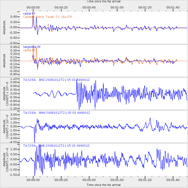
326A Caldwell Ranch, Toyah, TX, USA - Earthquake Result Viewer
*The percent match for this event was below the threshold and hence no stack was calculated.
| Earthquake location: |
Southern Bolivia |
| Earthquake latitude/longitude: |
-20.1/-65.0 |
| Earthquake time(UTC): |
2008/10/12 (286) 20:55:41 GMT |
| Earthquake Depth: |
353 km |
| Earthquake Magnitude: |
6.0 MB, 6.2 MW, 6.2 MW |
| Earthquake Catalog/Contributor: |
WHDF/NEIC |
|
| Network: |
TA USArray Transportable Network (new EarthScope stations) |
| Station: |
326A Caldwell Ranch, Toyah, TX, USA |
| Lat/Lon: |
31.32 N/103.98 W |
| Elevation: |
982 m |
|
| Distance: |
63.4 deg |
| Az: |
322.946 deg |
| Baz: |
138.578 deg |
| Ray Param: |
$rayparam |
*The percent match for this event was below the threshold and hence was not used in the summary stack. |
|
| Radial Match: |
68.066826 % |
| Radial Bump: |
400 |
| Transverse Match: |
51.42717 % |
| Transverse Bump: |
400 |
| SOD ConfigId: |
2556 |
| Insert Time: |
2010-03-07 04:55:24.173 +0000 |
| GWidth: |
2.5 |
| Max Bumps: |
400 |
| Tol: |
0.001 |
|
Signal To Noise
| Channel | StoN | STA | LTA |
| TA:326A: :BHN:20081012T21:05:03.499001Z | 5.625703 | 1.1949792E-6 | 2.124142E-7 |
| TA:326A: :BHE:20081012T21:05:03.499001Z | 4.690377 | 6.706526E-7 | 1.429848E-7 |
| TA:326A: :BHZ:20081012T21:05:03.499001Z | 4.651964 | 5.863451E-7 | 1.2604248E-7 |
| Arrivals |
| Ps | |
| PpPs | |
| PsPs/PpSs | |


