You are here: Home > Network List > IU - Global Seismograph Network (GSN - IRIS/USGS) Stations List
> Station KMBO Kilima Mbogo, Kenya > Earthquake Result Viewer
KMBO Kilima Mbogo, Kenya - Earthquake Result Viewer

| Earthquake location: |
Mindanao, Philippines |
| Earthquake latitude/longitude: |
9.9/125.5 |
| Earthquake time(UTC): |
2017/02/10 (041) 14:03:43 GMT |
| Earthquake Depth: |
15 km |
| Earthquake Magnitude: |
6.5 mww |
| Earthquake Catalog/Contributor: |
NEIC PDE/us |
|
| Network: |
IU Global Seismograph Network (GSN - IRIS/USGS) |
| Station: |
KMBO Kilima Mbogo, Kenya |
| Lat/Lon: |
1.13 S/37.25 E |
| Elevation: |
1950 m |
|
| Distance: |
88.4 deg |
| Az: |
268.59 deg |
| Baz: |
80.106 deg |
| Ray Param: |
0.042586423 |
| Estimated Moho Depth: |
40.75 km |
| Estimated Crust Vp/Vs: |
1.81 |
| Assumed Crust Vp: |
6.601 km/s |
| Estimated Crust Vs: |
3.652 km/s |
| Estimated Crust Poisson's Ratio: |
0.28 |
|
| Radial Match: |
91.74208 % |
| Radial Bump: |
385 |
| Transverse Match: |
74.82978 % |
| Transverse Bump: |
400 |
| SOD ConfigId: |
1992691 |
| Insert Time: |
2017-03-01 16:29:19.262 +0000 |
| GWidth: |
2.5 |
| Max Bumps: |
400 |
| Tol: |
0.001 |
|
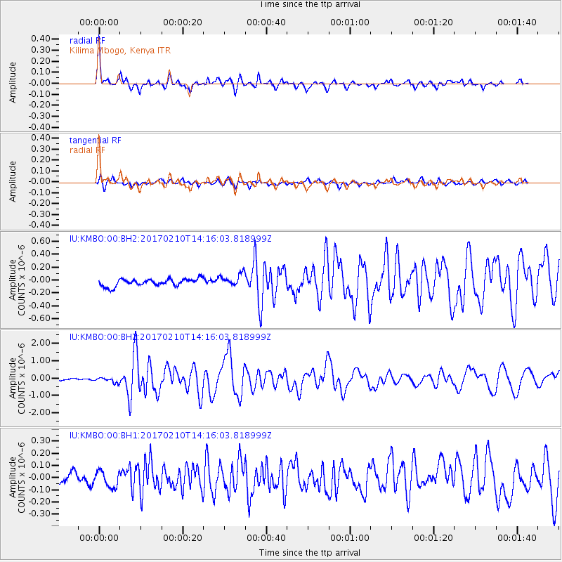
Signal To Noise
| Channel | StoN | STA | LTA |
| IU:KMBO:00:BHZ:20170210T14:16:03.818999Z | 2.3918996 | 1.5032147E-7 | 6.284606E-8 |
| IU:KMBO:00:BH1:20170210T14:16:03.818999Z | 1.2630526 | 6.5940135E-8 | 5.220696E-8 |
| IU:KMBO:00:BH2:20170210T14:16:03.818999Z | 1.745135 | 9.8695644E-8 | 5.6554736E-8 |
| Arrivals |
| Ps | 5.1 SECOND |
| PpPs | 17 SECOND |
| PsPs/PpSs | 22 SECOND |


