You are here: Home > Network List > IU - Global Seismograph Network (GSN - IRIS/USGS) Stations List
> Station PMG Port Moresby, New Guinea > Earthquake Result Viewer
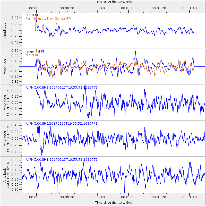
PMG Port Moresby, New Guinea - Earthquake Result Viewer
*The percent match for this event was below the threshold and hence no stack was calculated.
| Earthquake location: |
Northern Sumatra, Indonesia |
| Earthquake latitude/longitude: |
5.3/96.1 |
| Earthquake time(UTC): |
2017/02/15 (046) 19:47:08 GMT |
| Earthquake Depth: |
20 km |
| Earthquake Magnitude: |
5.6 mb |
| Earthquake Catalog/Contributor: |
NEIC PDE/us |
|
| Network: |
IU Global Seismograph Network (GSN - IRIS/USGS) |
| Station: |
PMG Port Moresby, New Guinea |
| Lat/Lon: |
9.40 S/147.16 E |
| Elevation: |
90 m |
|
| Distance: |
52.9 deg |
| Az: |
105.867 deg |
| Baz: |
283.882 deg |
| Ray Param: |
$rayparam |
*The percent match for this event was below the threshold and hence was not used in the summary stack. |
|
| Radial Match: |
54.92913 % |
| Radial Bump: |
400 |
| Transverse Match: |
56.646942 % |
| Transverse Bump: |
400 |
| SOD ConfigId: |
1992691 |
| Insert Time: |
2017-03-01 19:48:32.934 +0000 |
| GWidth: |
2.5 |
| Max Bumps: |
400 |
| Tol: |
0.001 |
|
Signal To Noise
| Channel | StoN | STA | LTA |
| IU:PMG:00:BHZ:20170215T19:55:52.168977Z | 3.778195 | 2.7870982E-7 | 7.3767985E-8 |
| IU:PMG:00:BH1:20170215T19:55:52.168977Z | 1.4411854 | 1.4827229E-7 | 1.0288218E-7 |
| IU:PMG:00:BH2:20170215T19:55:52.168977Z | 2.0306528 | 1.7595279E-7 | 8.6648384E-8 |
| Arrivals |
| Ps | |
| PpPs | |
| PsPs/PpSs | |


