Q23A Hartsel, CO, USA - Earthquake Result Viewer
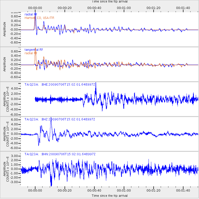
Earthquake location: Rat Islands, Aleutian Islands
Earthquake latitude/longitude: 50.4/177.0
Earthquake time(UTC): 2009/07/06 (187) 14:53:12 GMT
Earthquake Depth: 22 km
Earthquake Magnitude: 6.0 MB, 5.8 MS, 6.1 MW, 6.0 MW
Earthquake Catalog/Contributor: WHDF/NEIC
Network: TA USArray Transportable Network (new EarthScope stations)
Station: Q23A Hartsel, CO, USA
Lat/Lon: 38.90 N/105.83 W
Elevation: 2774 m
Distance: 53.7 deg
Az: 70.673 deg
Baz: 309.339 deg
Ray Param: 0.06587481
Estimated Moho Depth: 47.25 km
Estimated Crust Vp/Vs: 1.74
Assumed Crust Vp: 6.159 km/s
Estimated Crust Vs: 3.545 km/s
Estimated Crust Poisson's Ratio: 0.25
Radial Match: 93.882744 %
Radial Bump: 400
Transverse Match: 84.89201 %
Transverse Bump: 400
SOD ConfigId: 2648
Insert Time: 2010-03-07 04:57:14.633 +0000
GWidth: 2.5
Max Bumps: 400
Tol: 0.001

Signal To Noise

ChannelStoNSTALTA
TA:Q23A: :BHZ:20090706T15:02:01.648997Z12.5145452.0548428E-61.6419636E-7
TA:Q23A: :BHN:20090706T15:02:01.648997Z1.8752237.877056E-74.2005968E-7
TA:Q23A: :BHE:20090706T15:02:01.648997Z2.1048741.0145884E-64.820186E-7
Arrivals
Ps5.9 SECOND
PpPs20 SECOND
PsPs/PpSs26 SECOND