You are here: Home > Network List > US - United States National Seismic Network Stations List
> Station HAWA Hanford, Washington, USA > Earthquake Result Viewer
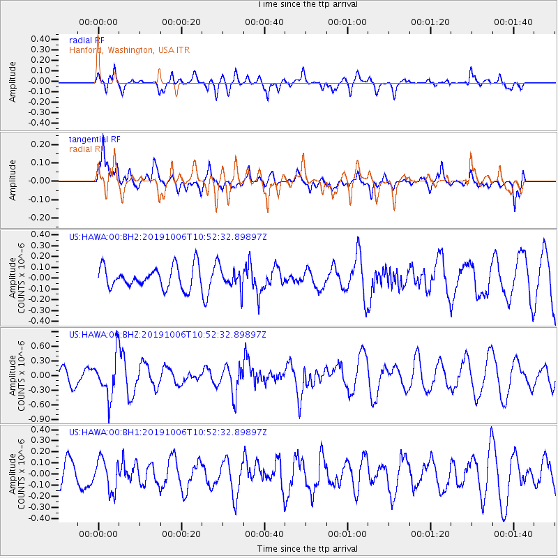
HAWA Hanford, Washington, USA - Earthquake Result Viewer
*The percent match for this event was below the threshold and hence no stack was calculated.
| Earthquake location: |
Chile-Bolivia Border Region |
| Earthquake latitude/longitude: |
-21.9/-68.6 |
| Earthquake time(UTC): |
2019/10/06 (279) 10:40:55 GMT |
| Earthquake Depth: |
112 km |
| Earthquake Magnitude: |
5.9 Mww |
| Earthquake Catalog/Contributor: |
NEIC PDE/us |
|
| Network: |
US United States National Seismic Network |
| Station: |
HAWA Hanford, Washington, USA |
| Lat/Lon: |
46.39 N/119.53 W |
| Elevation: |
364 m |
|
| Distance: |
82.1 deg |
| Az: |
327.129 deg |
| Baz: |
133.26 deg |
| Ray Param: |
$rayparam |
*The percent match for this event was below the threshold and hence was not used in the summary stack. |
|
| Radial Match: |
56.854595 % |
| Radial Bump: |
400 |
| Transverse Match: |
67.72989 % |
| Transverse Bump: |
400 |
| SOD ConfigId: |
19053131 |
| Insert Time: |
2019-10-20 10:50:00.053 +0000 |
| GWidth: |
2.5 |
| Max Bumps: |
400 |
| Tol: |
0.001 |
|
Signal To Noise
| Channel | StoN | STA | LTA |
| US:HAWA:00:BHZ:20191006T10:52:32.89897Z | 3.3227675 | 4.3019796E-7 | 1.2946978E-7 |
| US:HAWA:00:BH1:20191006T10:52:32.89897Z | 1.0289091 | 1.4474413E-7 | 1.4067729E-7 |
| US:HAWA:00:BH2:20191006T10:52:32.89897Z | 0.9246428 | 9.115878E-8 | 9.85881E-8 |
| Arrivals |
| Ps | |
| PpPs | |
| PsPs/PpSs | |


