You are here: Home > Network List > US - United States National Seismic Network Stations List
> Station MNTX Cornudas Mountains, Texas, USA > Earthquake Result Viewer
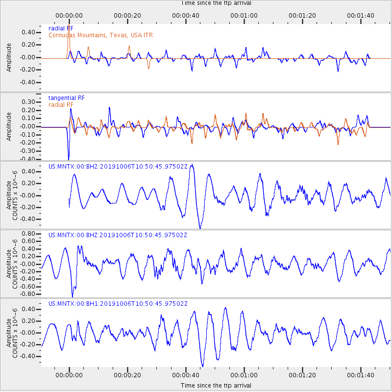
MNTX Cornudas Mountains, Texas, USA - Earthquake Result Viewer
*The percent match for this event was below the threshold and hence no stack was calculated.
| Earthquake location: |
Chile-Bolivia Border Region |
| Earthquake latitude/longitude: |
-21.9/-68.6 |
| Earthquake time(UTC): |
2019/10/06 (279) 10:40:55 GMT |
| Earthquake Depth: |
112 km |
| Earthquake Magnitude: |
5.9 Mww |
| Earthquake Catalog/Contributor: |
NEIC PDE/us |
|
| Network: |
US United States National Seismic Network |
| Station: |
MNTX Cornudas Mountains, Texas, USA |
| Lat/Lon: |
31.70 N/105.38 W |
| Elevation: |
404 m |
|
| Distance: |
63.9 deg |
| Az: |
325.337 deg |
| Baz: |
141.71 deg |
| Ray Param: |
$rayparam |
*The percent match for this event was below the threshold and hence was not used in the summary stack. |
|
| Radial Match: |
59.24397 % |
| Radial Bump: |
388 |
| Transverse Match: |
55.789547 % |
| Transverse Bump: |
400 |
| SOD ConfigId: |
19053131 |
| Insert Time: |
2019-10-20 10:50:04.502 +0000 |
| GWidth: |
2.5 |
| Max Bumps: |
400 |
| Tol: |
0.001 |
|
Signal To Noise
| Channel | StoN | STA | LTA |
| US:MNTX:00:BHZ:20191006T10:50:45.97502Z | 2.0649853 | 4.5449065E-7 | 2.200939E-7 |
| US:MNTX:00:BH1:20191006T10:50:45.97502Z | 0.5960125 | 1.13504505E-7 | 1.904398E-7 |
| US:MNTX:00:BH2:20191006T10:50:45.97502Z | 1.2510743 | 1.6745949E-7 | 1.3385255E-7 |
| Arrivals |
| Ps | |
| PpPs | |
| PsPs/PpSs | |


