You are here: Home > Network List > TA - USArray Transportable Network (new EarthScope stations) Stations List
> Station T11A Corn Creek, Alamo, NV, USA > Earthquake Result Viewer
T11A Corn Creek, Alamo, NV, USA - Earthquake Result Viewer

| Earthquake location: |
Vanuatu Islands |
| Earthquake latitude/longitude: |
-19.2/168.7 |
| Earthquake time(UTC): |
2007/08/05 (217) 09:28:40 GMT |
| Earthquake Depth: |
45 km |
| Earthquake Magnitude: |
5.6 MB, 5.5 MS, 6.0 MW, 5.9 MW |
| Earthquake Catalog/Contributor: |
WHDF/NEIC |
|
| Network: |
TA USArray Transportable Network (new EarthScope stations) |
| Station: |
T11A Corn Creek, Alamo, NV, USA |
| Lat/Lon: |
37.24 N/115.22 W |
| Elevation: |
1402 m |
|
| Distance: |
90.8 deg |
| Az: |
50.773 deg |
| Baz: |
246.578 deg |
| Ray Param: |
0.041637354 |
| Estimated Moho Depth: |
62.75 km |
| Estimated Crust Vp/Vs: |
1.76 |
| Assumed Crust Vp: |
6.276 km/s |
| Estimated Crust Vs: |
3.556 km/s |
| Estimated Crust Poisson's Ratio: |
0.26 |
|
| Radial Match: |
80.07528 % |
| Radial Bump: |
400 |
| Transverse Match: |
56.498974 % |
| Transverse Bump: |
400 |
| SOD ConfigId: |
2564 |
| Insert Time: |
2010-03-07 04:59:01.425 +0000 |
| GWidth: |
2.5 |
| Max Bumps: |
400 |
| Tol: |
0.001 |
|
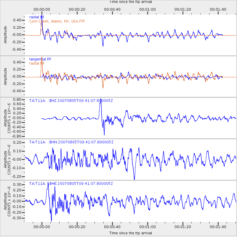
Signal To Noise
| Channel | StoN | STA | LTA |
| TA:T11A: :BHN:20070805T09:41:07.800005Z | 1.368482 | 4.7048786E-8 | 3.4380275E-8 |
| TA:T11A: :BHE:20070805T09:41:07.800005Z | 2.1747482 | 1.3344672E-7 | 6.136192E-8 |
| TA:T11A: :BHZ:20070805T09:41:07.800005Z | 8.246724 | 3.325332E-7 | 4.0323066E-8 |
| Arrivals |
| Ps | 7.8 SECOND |
| PpPs | 27 SECOND |
| PsPs/PpSs | 35 SECOND |


