You are here: Home > Network List > TA - USArray Transportable Network (new EarthScope stations) Stations List
> Station T11A Corn Creek, Alamo, NV, USA > Earthquake Result Viewer
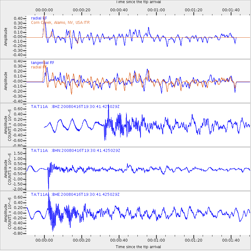
T11A Corn Creek, Alamo, NV, USA - Earthquake Result Viewer
*The percent match for this event was below the threshold and hence no stack was calculated.
| Earthquake location: |
Eastern Honshu, Japan |
| Earthquake latitude/longitude: |
39.0/140.0 |
| Earthquake time(UTC): |
2008/04/16 (107) 19:19:36 GMT |
| Earthquake Depth: |
166 km |
| Earthquake Magnitude: |
5.6 MB, 5.8 MW, 5.8 MW |
| Earthquake Catalog/Contributor: |
WHDF/NEIC |
|
| Network: |
TA USArray Transportable Network (new EarthScope stations) |
| Station: |
T11A Corn Creek, Alamo, NV, USA |
| Lat/Lon: |
37.24 N/115.22 W |
| Elevation: |
1402 m |
|
| Distance: |
77.3 deg |
| Az: |
52.273 deg |
| Baz: |
309.47 deg |
| Ray Param: |
$rayparam |
*The percent match for this event was below the threshold and hence was not used in the summary stack. |
|
| Radial Match: |
58.28613 % |
| Radial Bump: |
400 |
| Transverse Match: |
63.32718 % |
| Transverse Bump: |
400 |
| SOD ConfigId: |
2504 |
| Insert Time: |
2010-03-07 04:59:44.897 +0000 |
| GWidth: |
2.5 |
| Max Bumps: |
400 |
| Tol: |
0.001 |
|
Signal To Noise
| Channel | StoN | STA | LTA |
| TA:T11A: :BHN:20080416T19:30:41.425029Z | 2.0526688 | 4.685578E-7 | 2.2826761E-7 |
| TA:T11A: :BHE:20080416T19:30:41.425029Z | 2.0264542 | 2.9006867E-7 | 1.43141E-7 |
| TA:T11A: :BHZ:20080416T19:30:41.425029Z | 1.7029959 | 2.2970357E-7 | 1.3488204E-7 |
| Arrivals |
| Ps | |
| PpPs | |
| PsPs/PpSs | |


